After Bunker Hill’s first inhabitants migrated west, the Hill became an enclave of bohemian writers, visionary artists, and vanguard spiritualists. Right? It was, after all, home to the likes of Anna May Wong, Leo Politi, and John Fante; the book Bunker Hill, Los Angeles has a whole section dedicated to its more famed denizens, including pioneering female photographers and trailblazing gay rights activists.
But let’s not forget that Bunker Hill was the refuge of Jew-hating fascists, shall we? Today we shall consider the life and times of former Hill inhabitant Ingram Hughes, head of the American Nationalist Party, who published judeophobic books, plotted to seize armories, and murder Jews en masse.
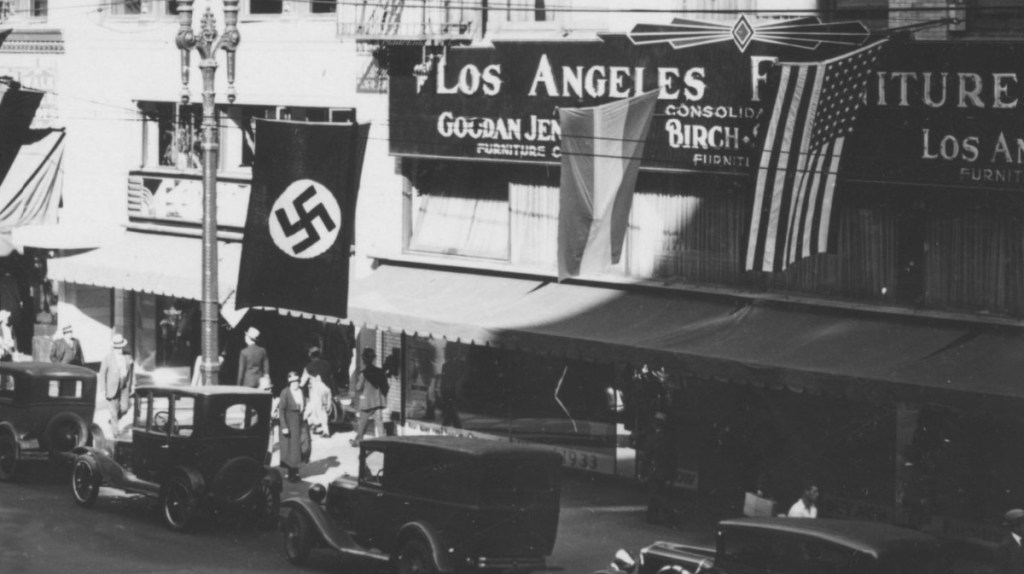
Ok, so it’s not a shot of Bunker Hill, but it’s too good not to use as the introductory image. The hakenkreuz is fluttering in the breeze here, at 724 South Broadway. CSUN
I. Ingram Hughes’ Early Life
Isaiah Ingraham Hughes Jr. was born to Isaiah Sr. (who was Ninth Illinois Cavalry, in the War Between the States) and mother Sarah Ada Abbot in Palouse, Washington, in 1875. At some point he develops his distaste for Jews, and it’s likely about that time he elects to go by a shortened-from-Ingraham “Ingram” (and abjuring Isaiah in toto, likely because it is a Hebrew name and all). He is educated at the University of Washington.
Hughes marries Nora Maude Tinsley (1869-1945) in King, Washington, in 1903. They move to San Diego in 1910, and Ingram Hughes is admitted to practice law before the State Supreme Court in 1914. Come 1920 they are separated, with Hughes (in the 1920 census as “Inghram”) living in Berkeley, and listed as a lawyer. They later reconciled and were living in Los Angeles in 1921.
There is some talk of divorce in 1928, and they separate (Maude moves with the boys to 1636 Lemoyne in Echo Park, where she lives for the rest of her days), but do not divorce until the mid-1930s. (Maude is listed as divorced in the 1940 census, and dies from stomach cancer in 1945.)
Los Angeles Times, 22 August 1928
In 1932 Ingram moves to Bunker Hill:
The 1933 Los Angeles City Directory, showing Ingram listed as a linotype operator, at 630 West Fourth St.
Before we get into what Ingram Hughes did, let’s talk a bit about his home at 630 West Fourth St.
II. The LaBelle Apts., 630 West Fourth St.
The LaBelle, 1912-1954
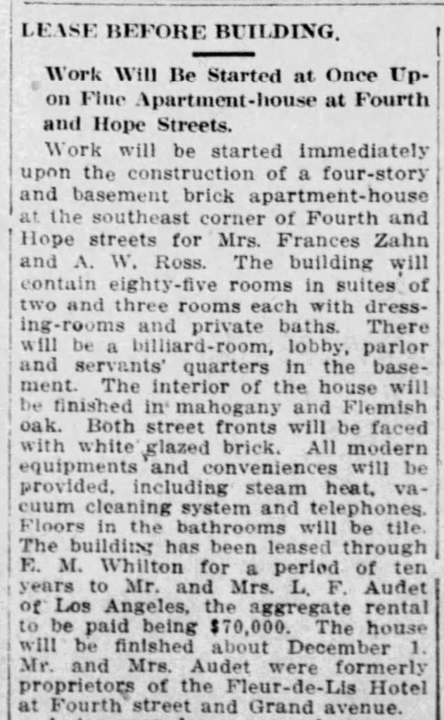
Once, on the southeast corner of Fourth and Hope Streets, there were these three peas in a pod:
These three were all built in 1912, by Mrs. Frances Zahn and A. W. Ross. The first to go up was the Gordon, so named because it was leased by Mrs. W. C. Gordon. Then came the LaBelle:
Frances Zahn is also noted for having torn down the family home on Bunker Hill—a few doors south on Hope Street—and replacing it with an apartment house called the Rubaiyat. All of her buildings were designed by Frank Milton Tyler.
From the WPA drawings:
The LaBelle at bottom left. These drawings can be found here. Make sure you subscribe to the Dusty Archive Substack!
This 1941 aerial shows Hughes’ apartment house on the corner of Fourth and Hope, X marks the spot:
As long as we’re on the subject of the famous and funky folk of the Hill, here’s an annotated shot, showing some of the neighbors (Blackburn and Head lived there before Hughes’ time, but Chandler and Mather were Bunker Hill contemporaries):
The LaBelle, April 1922. A bit of The Bronx to the left. At right, 401 South Hope, the 1886 home of George H. Williams
III. Ingram Hughes Gets to Work
So, Ingram Hughes moves into the LaBelle at the corner of Fourth and Hope in 1932, and sets out to educate fellow goyim about the pernicious Hebrew. From the confines of his Bunker Hill apartment, he founds his own political organization, the American Nationalist Party. His intention was to expand the party nationally, under his leadership, incorporating regional leaders e.g., the Ohio/New York pamphleteer Robert Edward Edmonson.
In 1933, in his capacity as a printshop linotypist, Hughes publishes Rational Purpose in Government: Expressed in the Doctrine of the American Nationalist Party, AKA American Nationalism as Expressing the Rational Purpose in Government : Being a Declaration of the Principles of the American Nationalist Party.
In 1934 he publishes Anti-Semitism: Organized Anti-Jewish Sentiment, a World Survey. It can be read in its entirety here.
In 1935, Hughes authors and publishes this proclamation—
—calling for the holiday boycott of all Jewish-infested media. Hughes printed an untold number of these at the Los Angeles Printing Company, 1204 Stanford Ave., where he worked the linotype (LAPC printed the weekly Nazi-leaning German-language newspaper California Weckruf; shopowner Joseph Landthaler was treasurer-secretary of the local Friends of the New Germany). The flyer was distributed widely by the FNG, who ran the Aryan Bookstore in the Turnverein Hall at 1004 West Washington Blvd. (and the one at Deutsches Haus, 634 West 15th St.); it was also plastered on much of Los Angeles, and was surreptitiously inserted into copies of the Los Angeles Times in the warehouse before delivery.
In late 1935 Hughes planned a pogrom, involving the mass hanging of twenty Jews, including Samuel Goldwyn and Eddie Cantor. Unbeknownst to Hughes, his personal secretary, Charles Slocombe, was a spy for the Los Angeles Jewish Community Committee, and the LAJCC worked with the LAPD to bug Hughes’ Bunker Hill apartment. They decided the heavyset, balding, bespectacled, 60-year-old Hughes was more bluster than determination in such matters. Hughes was, and rightfully so, worried that Jewish spies had infiltrated—not his, of course—too many local fascist organizations, making his murderous plans too risky.
In 1936 Ingram Hughes published Ye Kynge Goethe to Towne, a Ballade of Shreddes and Patches AKA The King Goes to Town, A Metrical Romance in Ballad Form, a compendium of “pilfered, pillaged, and purloined” verse. The text was accompanied by late-Medieval woodcuts, as chosen by Ingram’s 24-year-old son Owen Rhys Hughes (1912-1994). It can be read in its entirety here.
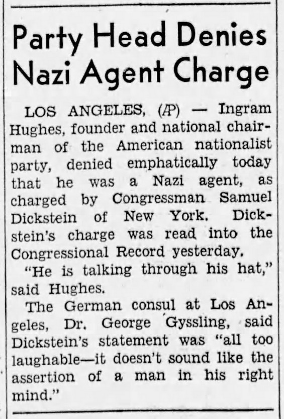
As evidenced by Ye Kynge Goethe, Hughes eventually eased up on the antisemitic screeds, preferring to simply output more anodyne, albeit conspicuously über-European, material. Nevertheless, in 1937, he was hauled before the McCormack-Dickstein Committee and grilled about his possible Nazi links:
San Pedro News-Pilot, 28 July 1937. Ironically, Dickstein, who was going after anti-American subversives like European-style fascists in Los Angeles, had a secret. The Democratic congressman was, at the time, a Soviet spy, under the employ or Moscow to root out and destroy American anti-Communists.
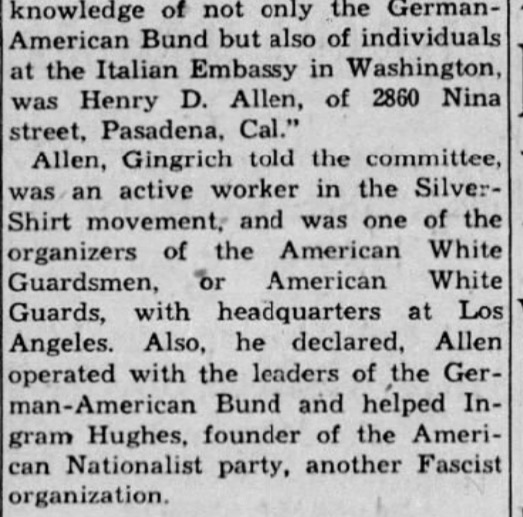
Hughes shows up again in the papers, mentioned in relation to the special House committee investigating subversive activities, in 1938:
Baltimore Sun, 07 October 1938
It’s the final time Hughes is mentioned in relation to fascism. A year and change later, his Bunker Hill address is listed as that for “Ingram Hughes, Publisher of Fine Books”—
Los Angeles Times, 11 February 1940/Los Angeles Times, 24 February 1940
He is still listed at the Fourth Street address in 1942, according to voter rolls, as a member of the Prohibition Party:
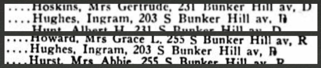
In the 1948 and ’50 voter rolls, Hughes has moved to 203 South Bunker Hill Ave.—
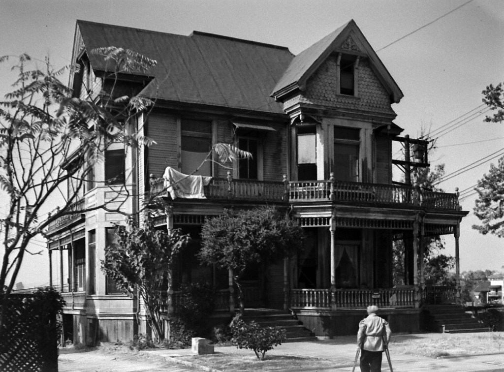
—and here is a shot of 203 SBHA in 1945; for all I know, that’s Hughes himself hobbling home:
And then he passes on December 27, 1949. Although he is listed in the 1950 voter rolls at 203 SBHA, his obituary places him about three miles to the southwest:
Los Angeles Times, 3 January 1950. Funny how his obituary doesn’t mention publishing all that Jew-hating, or his plans for a necktie party.
And that is the story of how, in the 1930s, Bunker Hill harbored one of Los Angeles’s fascist publishers. Of course, fascists, isolationists, and other such ilk became witheringly unpopular come 1941, with the attack on Pearl Harbor, eighty-three years ago today.
October is upon us—the time to celebrate all things dark, and weird, and similarly wonderful.
The perfect reading material for such times involves, of course, tales of murder and mayhem. And…Bunker Hill. Gosh, if only there was a publication about the twisted tales of terror from atop Bunker Hill…
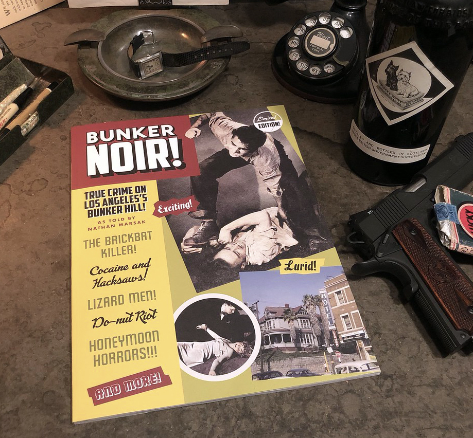
Huzzah! Bunker Noir!
Bunker Noir! is a compendium of everything strange and terrible that came from the Hill, which I published in a limited edition, and I’ve sold nearly all of ’em at $30 a pop. I’ve got one box left, which are for a limited time 20% off! If you’ve got yours already, this is the month you buy another as a Hallowe’en gift!
That’s right, what was once $30 is now a paltry $24. They are available at this October-only discounted price through the month of October, here on Amazon and eBay.
However, should you PayPal or Venmo me the $24 direct, I’ll send you your new copy of Bunker Noir!and pick up the costs of packing and postage myself, saving you a few bucks. (PayPal is eckener@kingpix.com, as is the Venmo.)
For more information about Bunker Noir! click here and here and here.
You know how much your loved ones delight in finding spooky books under the Hallowe’en tree
Couple Octobers ago, I wrote this post about former Bunker Hill resident James Oviatt, because at the time there was to be a tour of the Oviatt Building’s famed Olive Street penthouse, focusing specifically on its spookiness.
Well, the time has come for me to inform you that this season is similarly graced by a tour of the former digs of “Bunker Hill Boy Made Good” James Oviatt:
I should mention as well that this time, there will be an incredible display of vintage Hallowe’en costumes, from the collection of that brilliant wife o’ mine, Nicole! Plus cocktails! Music! Don’t miss the event of the season!
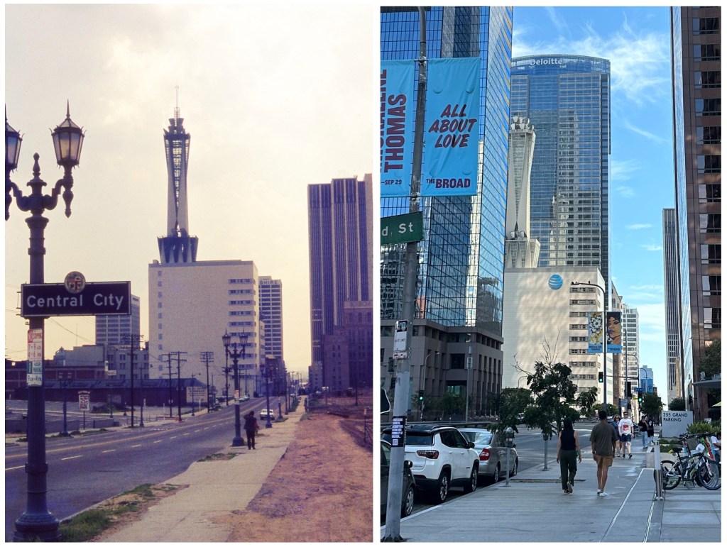
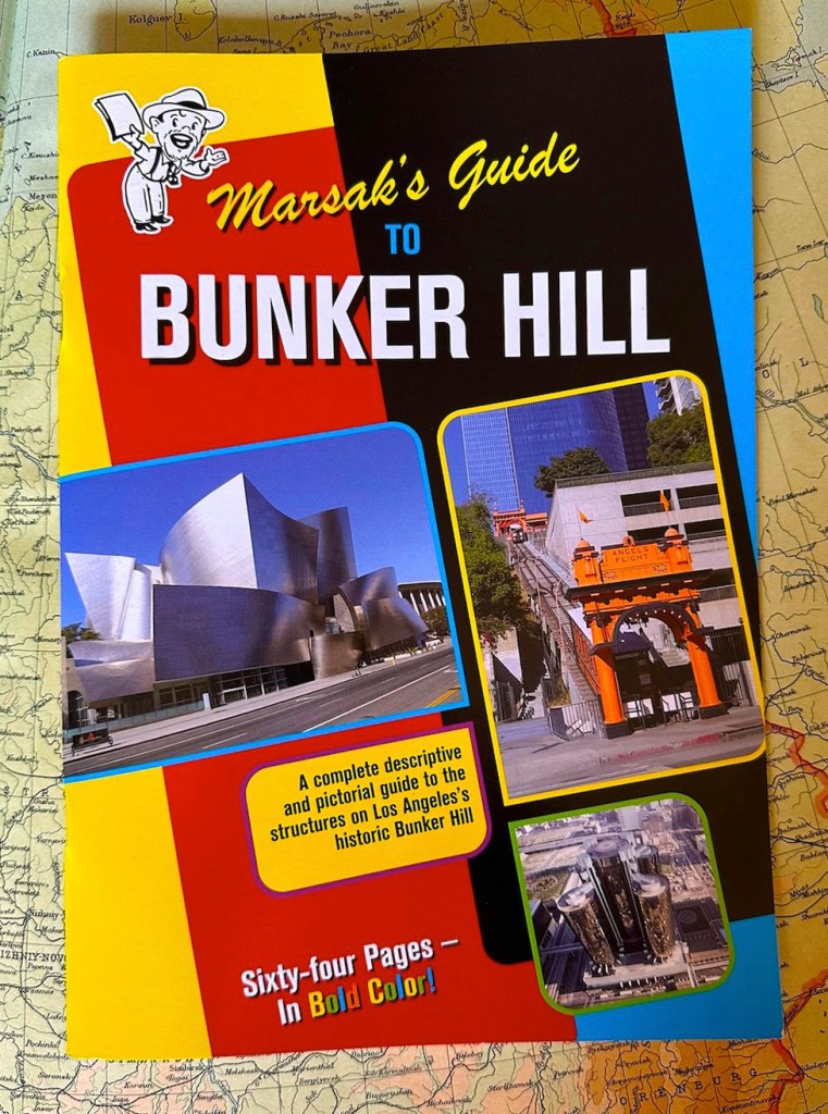
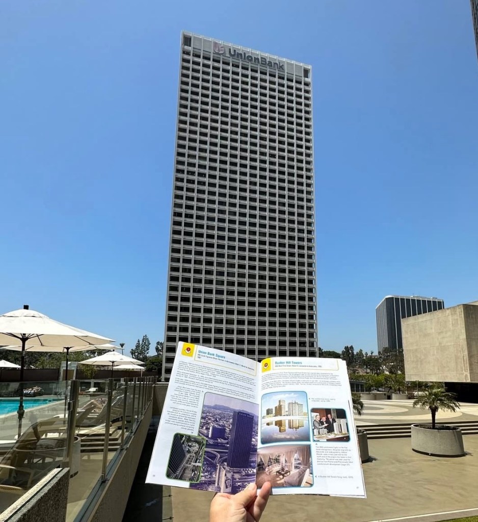
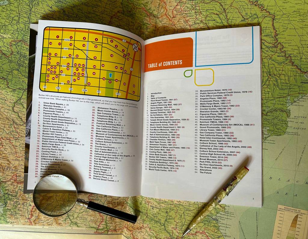
And now, for your edification and delectation (and as a shameless plug for Marsak’s Guideto Bunker Hill, on sale!) may I present the third and final installment of Bunker Hill Then-and-Nows: The Modern Years—
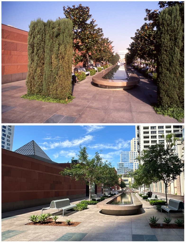
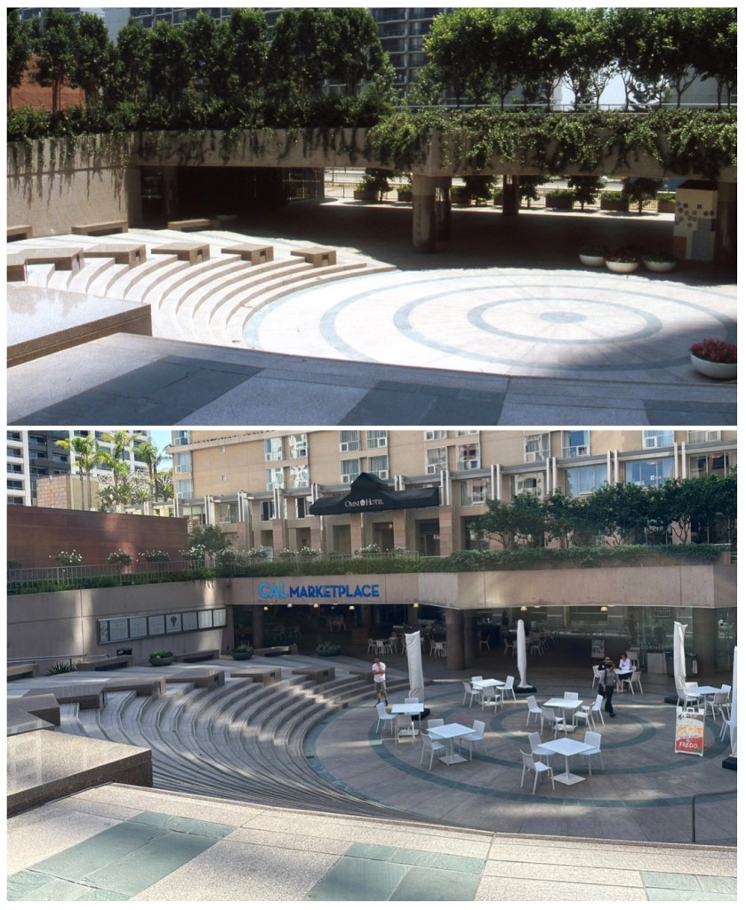
Looking west across the Music Center Plaza, August 1965. The view on the once-sunken plaza originally framed the neighboring DWP, flanked on either side by the Chandler and Taper. It is now however the scene of mass rallies in front of huge television screens (oft destroyed by blonde ladies flinging sledgehammers). The sculpture is Jacques Lipchitz’ Peace on Earth, dedicated May 1969, initially placed at the center of the plaza (since shunted off to the side in the recent Rios Clementi Hale reconfigure). At the dedication, Lipchitz stated “if peace does not come, it’s a bad sculpture.” Well… Looking north on Hill from near Fourth Street, July 1980. Behold the famed retaining walls, adjacent the slot where Angels Flight would be returned in 1996. Rising above, Angelus Plaza nears completion. Looking north inside California Plaza, ca. 1987. The reflecting pond (leading to the fountain) and original seating remains. It took vision and dedication to plant mature magnolias and cypress, which have since been replaced. The view west on Fourth Street from Grand Avenue, April 1981. At left, under construction, is the Manulife Plaza, a project of Manufacturer’s Life Insurance Co. (Albert C. Martin & Associates, 1982); that view is now blocked by the Ketchum YMCA (also AC Martin, 1986). Inside the Security Pacific Bank plaza, looking west, March 1984. Security Pacific’s 1974 gardens, by Sasaki, Walker & Associates, included an orchard of evergreen pears, with fountains cascading to a lower pool (intended to connote a Mayan cenote). The whole was ringed in jacaranda above and willows below, with masses of flowering plants throughout. The narrow fountain pools are based on Spain’s Alhambra and, though they are dry in our Sunday-shot “now” image, they do run on weekdays. “Most clients ask us for a plaza,” said principal Peter Walker in November 1975, “but Security Pacific asked us for a park, and that makes all the difference.” The gardens at Security Pacific are arguably the best spot in Los Angeles; owner Brookfield (the Toronto megacorp famous for demolishing Bunker Hill’s Halprin atrium at Crocker Court) intends to put a tower there. Looking south on Grand Avenue, ca. 1983. This image shows the O’Melveny & Myers Tower (Robert Tyler for Welton Becket Associates, 1982) with some of its original sixty-eight Italian cypress that ringed the structure (along with runnels and other water features, also lost). Dallas-based CBRE Group bought the tower in 2012, and while it retains that name on its facade, CBRE sold the building in 2016 to a partnership of Pittsburgh’s PNC Realty and Munich’s GLL Real Estate. Behind, the Library Tower looms o’er grandly. Inside California Plaza, looking south with Grand Avenue at right, July 1986. Above and behind the trees, the lower portion of skyscraper One California Plaza, which opened in December 1985; the plaza is oh so very, very Arthur Erickson. Though it has lost its planter pots and they’ve trimmed away the charm of hanging vines, the property remains remarkably intact. Less intact are crucial elements of Erickson’s Cal Plaza design, including the water features in neighboring parts of the plaza, now lost (e.g. this and this).
Looking southwest from near Temple at Hope, August 1967. This grouping of Inyo County boulders, at the northeast corner of the Department of Water and Power campus, are a significant, and fairly unknown, element of the DWP landscape. (For another nifty vintage pic of the grouping, check out this 1965 Shulman.) In doing this then-n-now, I discovered to my horror that one of the rocks (the smallest at center-left) was missing! The plaque in the modern photo (left) reads “These ancient granite boulders were brought from picturesque Alabama Hills in Owens Valley. The rocks are estimated to be 200 million years old. Owens Valley is the source of a large portion of the water service for the City of Los Angeles.” I don’t have to tell you, of course, that that plaque leaves out a lot of…stuff.
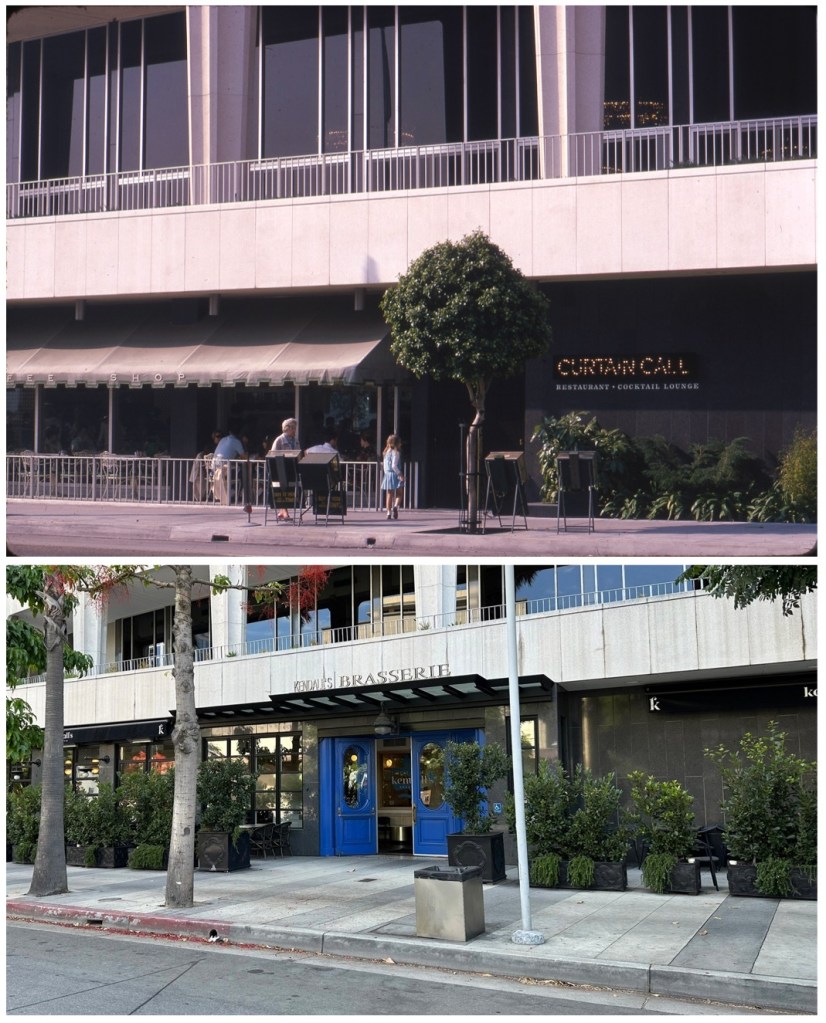
Looking southwest on Grand Avenue toward the Music Center, January 1967. When have you ever seen a shot of the Curtain Call? (If you have one, I showed you mine, you show me yours!) The fifth floor of the Dorothy Chandler Pavilion contained the large and elegant Pavilion Restaurant; downstairs was its smaller, warmer neighbor, the Curtain Call. Curtain Call was decorated with mementos of early Los Angeles theatrical life. Note that the bulb signage in the 1967 shot was used in its advertising, like this matchbook; as a Fred Harvey, with a penchant of vintage LA theater, it had an “olde-tyme” feel to its branding. The Curtain Call became a Hungry Tiger in 1980, which became Otto Rothschild’s Bar and Grill in late 1986. The space has housed Kendall’s Brasserie since November 2003.
I trust you have enjoyed these last three weekends full of Bunker Hill Then-and-Now photography.
If you’ve found these investigations of modern Bunker Hill interesting, might I suggest you buy the book! And again, I thank you for your attention.
As promised, more then-and-nows!Part I of our three-part then-and-now extravaganza can be enjoyed by clicking here (and there’s a Part III as well).
I’ll admit, these then-and-now posts serve a twofold purpose: to broaden the discussion regarding contemporary Bunker Hill, certainly, but also to whet your appetite for exploring modern Bunker Hill’s structures, which is best done by buying a copy of Marsak’s Guide to Bunker Hill. (It would be extremely prudent to so this month, given as they are on massive sale, about which you may learn everything by simply clicking here.)
Now, on with the show!
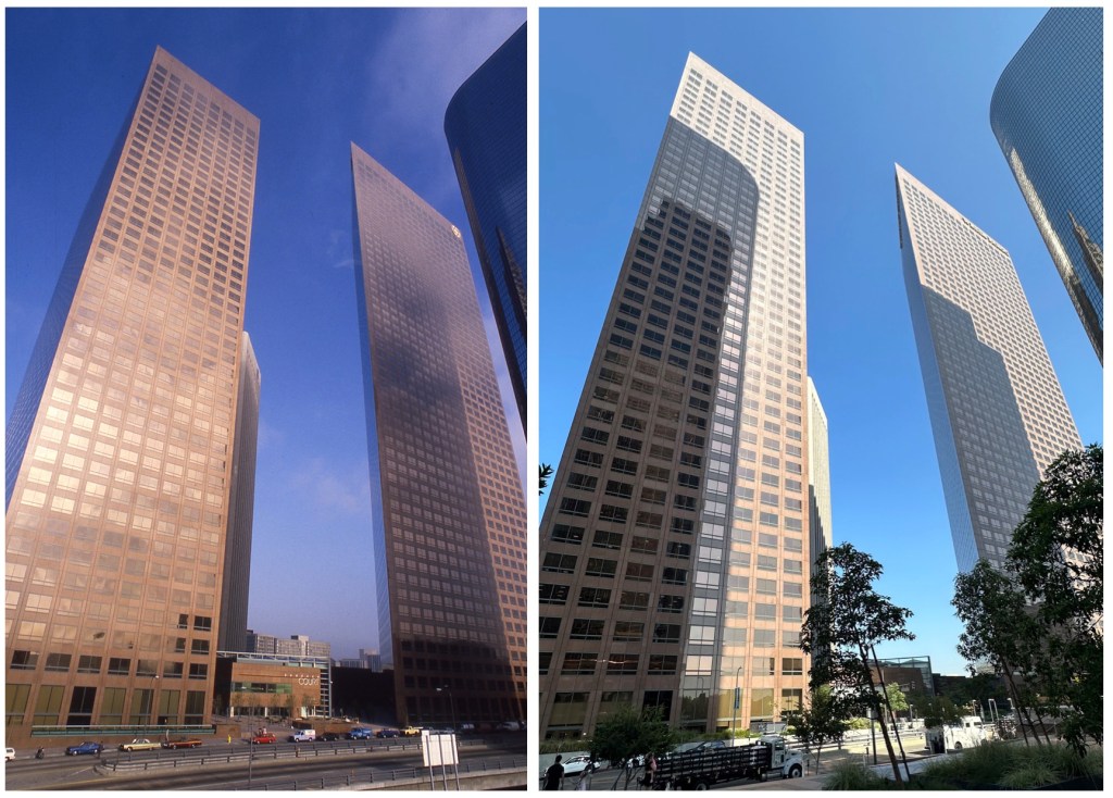
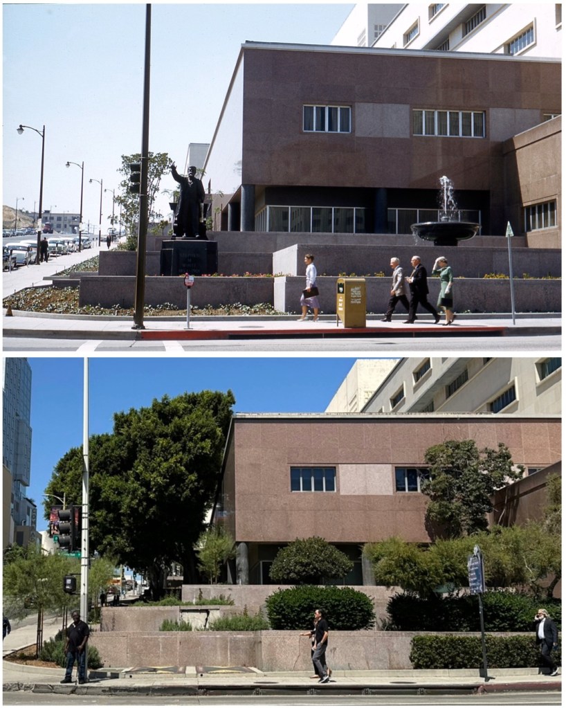
Looking south on Figueroa across Third Street, ca. 1985. Shot from the pedway connecting Bunker Hill Towers to The Park (a pedway in the distance connects the World Trade Center to the Sheraton Grande). Note the two-way Figueroa traffic; Figueroa became one-way northbound from Olympic to Third in December 1986. Also note Union Bank, upper right, has been painted white, in an early-90s remuddling by owners Equitable-Nissei. South of Bunker Hill, a number of towers have sprung up; most eye-catching is a glimpse of the curious Châteauesque roofline of the Home Savings Tower (Tim Vreeland/AC Martin, 1988).Looking south on the west side of the DWP “moat,” circa 1966. Prominent in the vintage image, the mighty Union Bank, still unmolested by white paint-slathering morons. At far left the Richfield Building and behind the fountain, the Architects Building, both replaced, now, by the ARCO Towers (seen poking out, just a bit, behind the 1968 Bunker Hill Towers, at left in modern image). The view to the southwest, where once we saw the Union Oil Center, is now blocked by the Promenande Towers, with 333 Beaudry behind—the Beaudry Center is by the now-forgotten William Rockhold, of Nadel Partners, the group who reached the absolute nadir (or would it be zenith?) of 1980s Los Angeles vacuity.Looking north on the hill near Hope and Third Streets, August 1968. The contemporary view is lower, since the hill was cut down for the Security Pacific Bank plaza. The structure at right is the 1966 cooling plant. Under construction is Bunker Hill Towers.Looking east across Grand Avenue toward the Crocker Center, July 1987. Note the Crocker Court, which once contained the Halprin atrium, as mentioned last week.The view north on Grand Avenue from near Third Street, ca. late 1986-early 1987. Behind, now, the Grand, the Colburn Expansion, and Museum Tower. And hey! Say what you will about our descent into barbarism, at least now we have trees.Looking west up First from Hill Street, May 1959. If the statue of Stephen White were still there, its pedestal would obscure the missing broken panel on the Courthouse. Look closely up First and you’ll see the Majestic/Lima/Rossmere at First and Hope Streets, two years prior to its July 1961 demolition.Looking east near Grand Avenue and Third Street, into California Plaza, circa 1988. Note that once you could look straight through at Angelus Plaza, fronting Olive Street, before the construction of Cal Plaza’s Hotel Inter-Continental.
The view south on Grand, November 1965. The Pacific Telephone Communications Center main entrance is marked with a mosaic mural by Anthony Heinsbergen, dedicated in May 1961. On the mural Heinsbergen attached coin box chutes and capacitors and other telephone components. The figure at center holds aloft tranatlantic cables and a satellite transmitter, and above, Echo One, the first Bell communications satellite, relays a radio transmission beamed to Russia. Heinsbergen’s vision also featured an odd placement of the continents, including an upside-down Australia. Los Angeles Times columnist Jack Smith launched a (tongue in cheek) crusade through the 1970s to have Australia righted, involving telephone company executives and the Australian consulate. Smith may or may not have had a hand in righting the continent, but at some point it was in fact removed, turned right side up, and reattached.
That’s it for today! Tune in next weekend for Part III! And remember, you can’t tell the players without a program!
Who doesn’t love a good then-and-now photo comparison? (If you hang around this blog, I’m gonna say you do at least). When I moved to Los Angeles thirty years ago, one of my first windows into Old LA was Gernot Kuehn’s Views of Los Angeles, an incredible then-and-now photobook published in 1978 (another reason you should get a copy is the 1970s “now” photographs are themselves amazing, and Kuehn’s Views deserves a contemporary “then and now and now” updating).
As regards Bunker Hill, of course, one issue with comparing past to present is the absolute obliteration of the landscape (e.g. this and this from Brian Hsu’s Urban Diachrony). A tangled nest of Victorian wooden buildings compared with some modern concrete behemoth isn’t nuanced; it’s just jarring.
So, I thought it would be interesting to compare modern Bunker Hill with…slightly more modern Bunker Hill. To this you may exclaim “what’s the point of comparing the Security Pacific Bank with…the Security Pacific Bank? It still looks the same!” and you’d basically be right. In any event, I’m going to compare some relatively recent shots of postredevelopment Bunker Hill with how it looks at present, just to gauge its changes, no matter how minor. This I do because it’s fun and interesting, but also underscores how much of “new” Bunker Hill is itself reaching its dotage—much of postredevelopment Bunker Hill is actually older than much of “vintage” Bunker Hill was when demolished in the 1960s—and as such, we’re in for preservation concerns among the modern landscape (a theme touched on in the last few paragraphs of this post).
Also, it occurred to me that I will likely go to my grave without anyone seeing even a fraction of my collection, including all those binders stuffed full of delightful (though less-desirable-to-the-masses) ’70s snapshots and ’80s Kodachromes. So, why not do a post that features some of ’em, just for kicks? Let’s go!
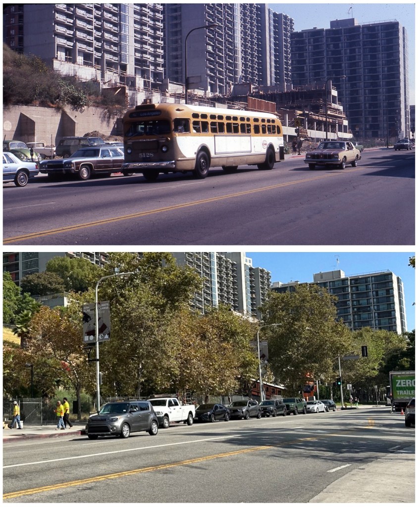
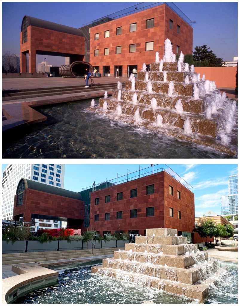
Looking south on Grand Avenue across Temple Street, March 1985. Note at left, the Crocker logo (Peter Graef, 1970), and at right, the Security Pacific logo (Saul Bass & Assoc., 1966), and between the two, the 1962 Wells Fargo “diamond” logo, designed by Walter Landor Associates, which WF ditched about 1995. Bottom image, post-1985 additions to the landscape include the Library Tower, the Wilshire Grand Center, and Disney Hall, glimpsed behind the Chandler Pavilion. Looking north on Hill across Fourth Street, January 1976. Today that hill maintains it basic contours (though the shape of old Clay Street has mostly disappeared), and is now known as Angels Knoll, or maybe Angels Landing, in any event, it’s totally fenced off, to the consternation of those wishing to recreate 500 Days of Summer. The bits of retaining wall glimpsed behind the bus I covered at length, here. That tree is of course of enormous importance, and lives to this day in the forecourt of Angelus Plaza, where it was moved in 1981. We’re told that, someday, this area—site of an unrealized third Cal Plaza tower—will look like this, but I wouldn’t hold my breath. Looking north across the Music Center Plaza toward the Mark Taper Forum, September 1967; in this image, the Taper had been open five months. The coolly elegant sunken plaza was designed by Cornell, Bridgers, & Troller, whose municipal projects included the nearby Civic Center Mall and the Department of Water and Power. Five years ago, the Music Center was “reimagined” by Rios Clementi Hale Studios, removing the sunken element so that mass rallies could be had in front of giant television screens. The area has since been renamed Jerry Moss Plaza; Moss was the “M” in A&M Records. Check out another nice vintage shot of the Taper and plaza on p. 21 of Marsak’s Guide.(Did I mention Marsak’s Guide to Bunker Hillis on sale?)Looking west from California Plaza toward the Museum of Contemporary Art, ca. 1987. Ah, MOCA, the World’s Worst Designed Museum™ (as discussed on p. 46 of Marsak’s Guide). Time was, you could stroll straight up onto MOCA’s forecourt from Cal Plaza, but the museum has since controlled that entrance. I’m thrilled the fountain is still there (water features are always the first to go) but its jets have gone a bit limp. The two major structures in the bottom image are the goofy-windowed Emerson Tower, left, and The Grand, right. Fun fact: my time at MOCA helped kickstart a fascination with Bunker Hill, so, I very much owe them that.
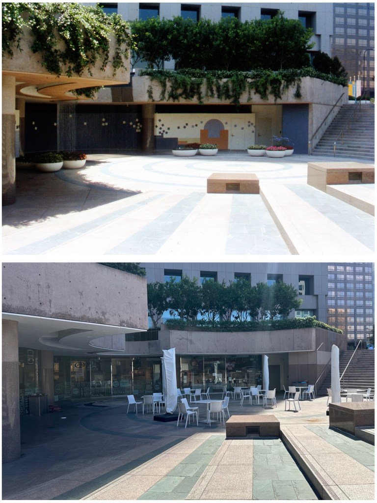
Crocker Court, July 1986 (known as Well Fargo Court after November 1987). In 1980, Crocker Bank commissioned famed landscape designer Lawrence Halprin to create an atrium filled with gardens, water features, and sculptures, as the centerpiece of the Crocker Center project, The $20million atrium was conceived of as “an urban, indoor Garden of Eden,” later described by Halprin as “a psychologically restoring haven.” Brookfield Properties bought Wells Fargo Center and demolished Halprin’s work in its entirety, replacing it with this inspiring laminate-covered food court. I discuss Crocker Court a bit in this video and, of course, in Marsak’s Guide.
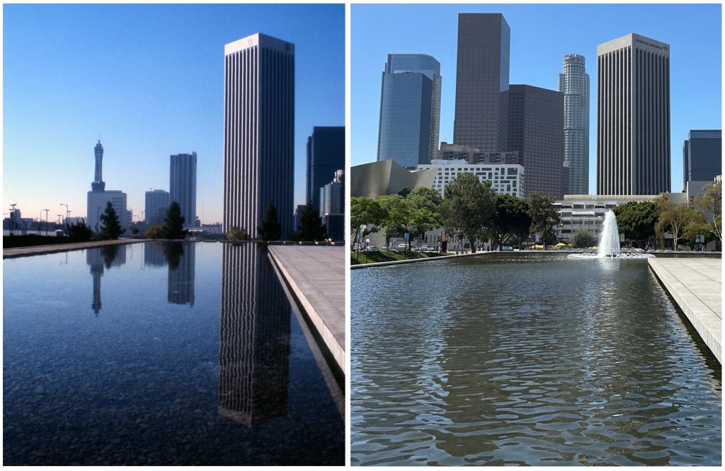
Looking north on Grand Avenue across Fifth Street, February 1978. The mighty Edison Building—as seen on p. 10 of Marsak’s Guide—stands proud and relatively unaltered: when ownership group Rising Realty/Lionstone/Hermes bought the building ten years ago, they pledged to rip off all those 1980s “greenhouse” additions; while they did replace the fourth-floor balcony greenhouses with canopy structures, the upper story greenhouses remain. The new owners also renamed the building CalEdison, which is all fine and good, but why can’t the neon lettering (as seen, for example, on p. 149 of the Big Book) be returned to its roof? At far left, note venerable survivor the Engstrum (BHLA, p. 169) which was finally replaced, of course, by the Library Tower. Note in left foreground, the low wall, enclosing Central Library’s east lawn at the southwest corner of Fifth and Grand, until replaced by this (Hardy Holzman Pfeiffer Associates, 1993).Looking south across the east side of the reflecting pool at the Department of Water and Power, ca. 1976. There are few things I love more than the incredible “moat” that encircles the DWP building. (The fountain seen in the contemporary image is original to the DWP; it just wasn’t running when the earlier image was shot.) Look closely and you’ll note the pool was once lined in Mexican pebble. Also, if you look very closely, left, you’ll see the pool once had a border of rectangular aggregate panels, raised above the water’s surface on supporting members. Of course, in the distance, a whole host of new towers block some of the structures (Crocker-Citizens Bank, Pacific Telephone) that appear in the earlier view. Security Pacific is dwarfed by new neighbors, and Promenade East now obscures its bottom. Note that at far right, the ARCO towers—once, matching twins of Miesian grandeur—have had their bilateral symmetry ruined when A C Martin’s facade was bastardized (which I talk about, a bit, here). The view south on Grand Avenue from Third Street, April 1969. Most prominent is PacTel at 420 South Grand Ave., with its signature microwave tower. Also prominent in the 1969 shot is Crocker-Citizens, right, now obscured by the Wells Fargo (née Crocker) Center. Hey, if you really want to geek out on Hill minutiae—this building is the garage at 318-322 South Grand (seen here in 1962 and 1950). It was demolished by the CRA in June 1969, two months after the image at left was captured. And do you know who designed that garage in 1917? Albert C. Martin! And the “new” Bunker Hill has AC Martin represented via a number of structures including the DWP, Union Bank Square, Security Pacific Bank, Wells Fargo Bank, and Ketchum YMCA.
Ok! Well that’s some of the then-and-nows I have on hand. Come back next Sunday, when I’ll post another gaggle of these!
Well good thing for you Marsak’s Guide to Bunker Hill is now 25% OFF!
That’s right, what was once $20 is now only $15. Marsak’s Guide to Bunker Hill is available on eBay and naturally on Amazon, sure, but:
…you’ll end up paying a few extra bucks for shipping should you go the eBay/Amazon route, which is fine; although, if you Paypal/Venmo me directly, it’s FIFTEEN EVEN and I’LL COVER THE PACKING AND POSTING!
****Get yours now, because when they’re gone, they’re gone!****
(no seriously, the cost of printing has skyrocketed in the last couple years, and if I reprinted these I’d have to charge $40 a pop, and no-one wants that)
as is the Venmo: eckener@kingpix.com AKA @Hugo-Eckener
Still on the fence? Read more about Marsak’s Guide to Bunker Hillhere, and see what local felines have to say on the matter here, and view a helpful instructional video here.
OH! And come back to this blog tomorrow, Sunday Sept. 1, when I will present a then-and-now post involving modern/contemporary Bunker Hill that shall fill you with wonder, and absolutely convince you to buy two copies.
“And once you have your copy, you too can gaze languidly, and confidently, into a future replete with greatness and intrigue.” —Boris
Time to check in on the bunk! Now, bunk is not a word you hear often—bunk being short for bunkum. Bunkum means foolish claptrap and lemme tellya, our silly world of Los Angeles is all-fire replete with that.
Plus, you know, bunk, Bunker Hill, it all ties together. Lately I’ve taken to task the bunk-ridden establishment narratives about Bunker Hill-related topics like Cooper Donuts, Chavez Ravine, and Pershing Square, and I thought it would be fun to “check in” on these subjects and see how the ruling class is conducting itself of late.
Why do I care? Some of you might say “well, you’re an old meanie, just trying to tear down the stories of marginalized people!” and of course the opposite is true. I’m all for the stories of marginalized people, but those stories have to be accurate. Inaccuracy makes me angry and offended in general, but particularly when it bleeds into Los Angeles history. Don’t believe me? I once played LA Noire for an hour and the next day wrote five thousand words about its inaccuracies. I saw Ask the Dust and nitpicked the living hell out of it. And those are fictional/fictionalized depictions—stuff like Coopers/Chavez/Pershing is the government and other unethical folk telling us “we now provide you the true version of actual historical events, which you know to be true because…we say so” when they are, knowingly or not (spoiler alert: knowingly) peddling blatant untruths.
So! Without further ado, let’s poke our noses into what’s new around town—
***COOPER DONUTS***
As you are undoubtedly aware, it has been conclusively proven that there was never a Cooper Donuts riot (the only person who ever claimed an unverifiable kerfuffle even happened and/or was a witness to said event, stated it did not happen at a Cooper’s) AND it has been conclusively proven there was never a Cooper Donuts anywhere near the famed gay bars on the 500 block of Main Street (e.g., Harold’s at 555 South Main…and no, before you say “well it happened at Second and Main which is nearby and has to be true because Kevin de León put a plaque there” be advised that is, as well, false, because there was no Cooper Donuts anywhere near that corner in either the spring of 1958 or 1959, when said lone witness claimed the event occurred).
And yet, these simple facts didn’t stop muralist Judy Baca, who depicted the myth on a mural at LACMA.
In her cynically dishonest artwork, Cooper’s—represented as sited adjacent Harold’s—was the location where trans POC battered LAPD with pink donuts. Let’s agree it’s a nice picture and is uplifting for the LGBTQ+ community, and isn’t that the point, stories that fill us with pride? In which case it’s no different from, say, a grand salon painting of Napoleon’s triumph at Waterloo. Let’s pretend for a moment that a monumental nineteenth-century canvas called Napoleon’s Triumph at Waterloo hangs in the Louvre, and that picture is a magnificent source of emotional and spiritual uplift for the citizens of France, I suppose, despite it being based on absolute horseshit. A French reverence for that painting wouldn’t make the French look strong and proud; it would make them look foolish.
Any mention of Baca’s work will tell you she consulted historians and scholars, but of course I don’t have to tell you, painting a fanciful image of something that didn’t happen is the opposite of history. It’s ironic that what she is painting is assuredly not history, despite the mural’s official title being The History of California.
Buried Under the Blue, who triumphantly exclaimed “we did it!” when the bill was announced, have since become really cranky about the bill, and critical of the bill’s author, Councilmember Wendy Carrillo. Apparently all BUtB really wanted to do is go after the Dodgers (guess they figure it’s better optics to go after the deep pockets of a corporation, than the deep pockets of taxpayers). But, to Carrillo’s credit, since the Dodgers had nothing to do with the depopulation of Chavez Ravine, Carrillo left them out of the bill. BUtB’s frothing hatred of the Dodgers being so pronounced, they have since, therefore, branded Carrillo a traitor to La Raza.
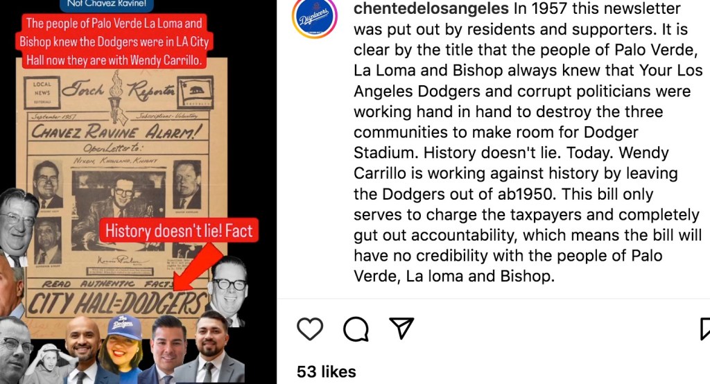
In other news, BUtB has recently posted a couple shots of an anomalous 1950s self-published newsletter that’s online at UCLA. BUtB again attempts some gaslighty slight-of-hand by putting a screengrab on social media and then claiming “look! This archival document PROVES all sorts of malicious Dodger forethought and diabolical political activity!” when, of course, a study of the actual material doesn’t bear that out at all. (BUtB has done this sort of thing before, like when they posted a shot of a letter and said “look! Here’s PROOF the Dodgers knew about La Loma, Palo Verde and Bishop years before they came to Los Angeles and were working actively to destroy the communities!” when of course should you actually read the letter, it says nothing of the sort.)
In this case BUtB at last discovered the 14-page newsletter (in my day we’d have called it a ‘zine) online at UCLA, called the Torch Reporter, printed in September 1957. According to BUtB, it was put out by “residents and supporters.”
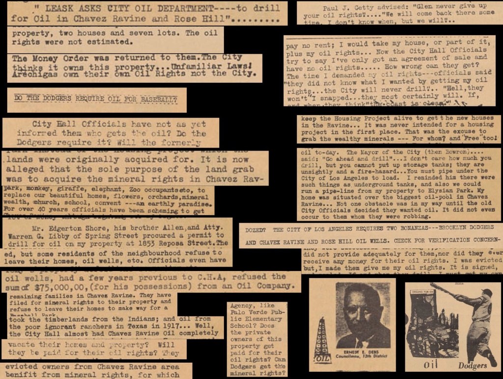
True, it was put out by a supporter—a lone woman named Tara Joyce, who lived in Hollywood. The September ’57 Torch Reporter is full of Chavez Ravine (Joyce subsequently dropped Chavez Ravine and turned her attention, in the next issue, to the question should West Hollywood incorporate as a municipality?) and exists as a minor, but interesting, piece of Chavez curiosa: Joyce was all worked into a froth, especially, because she worried about oil. Yes, back in the day, the big question was who was getting the mineral rights? According to the Torch Reporter, there was never a plan to build public housing; that was all misdirection in the greater scheme to steal Chavez residents’ precious oil—which only residents of Chavez Ravine should be allowed to drill. Drill, baby, drill!
Twenty-plus mentions of oil rights in a mere fourteen pages. Apparently, Buried Under the Blue are yelling about “land back” so they can start fracking…
In any event, BUtB discovered the Torch Reporter online and said “this proves” City Hall and the Dodgers were at work to knowingly and specifically destroy La Loma, Palo Verde, and Bishop.
Note top right it says they’re “collecting archival documents.” As someone whopainstakingly maintains a climate-controlled archive, you taking screengrabs does not count as “collecting archival documents.”
See the Instagram screengrab above, claiming here exists “proof” the mayor was working to “take our homes”? Yeahhhh, so, if you actually read this page of the Torch Reporter, it only discusses how that, during one of Mayor Poulson’s speeches, Poulson didn’t mention Chavez Ravine, and Tara Joyce is irked because she thinks he should have. (A similar conversation— Joe: “Did you know Eisenhower used ray guns to kill all the Portuguese? I have proof!” Bob: “How do you have proof of that?” Joe: “Because Eisenhower gave a speech, and made no mention of it!”)
Besides being largely about retaining mineral rights, Joyce’s Torch Reporter contains all sorts of wild claims: for example, that 7,500 families were removed (um, nooooo). It claims the Church of Santo Niño, at 1034 Effie, was “built by the evicted families of Chavez Ravine” (it was built by the Diocese). And so forth. The first-person accounts by Glenn Walters and Alice Martin are exceptionally interesting and valuable, though. Read it all for yourself by clicking here.
***PERSHING SQUARE***
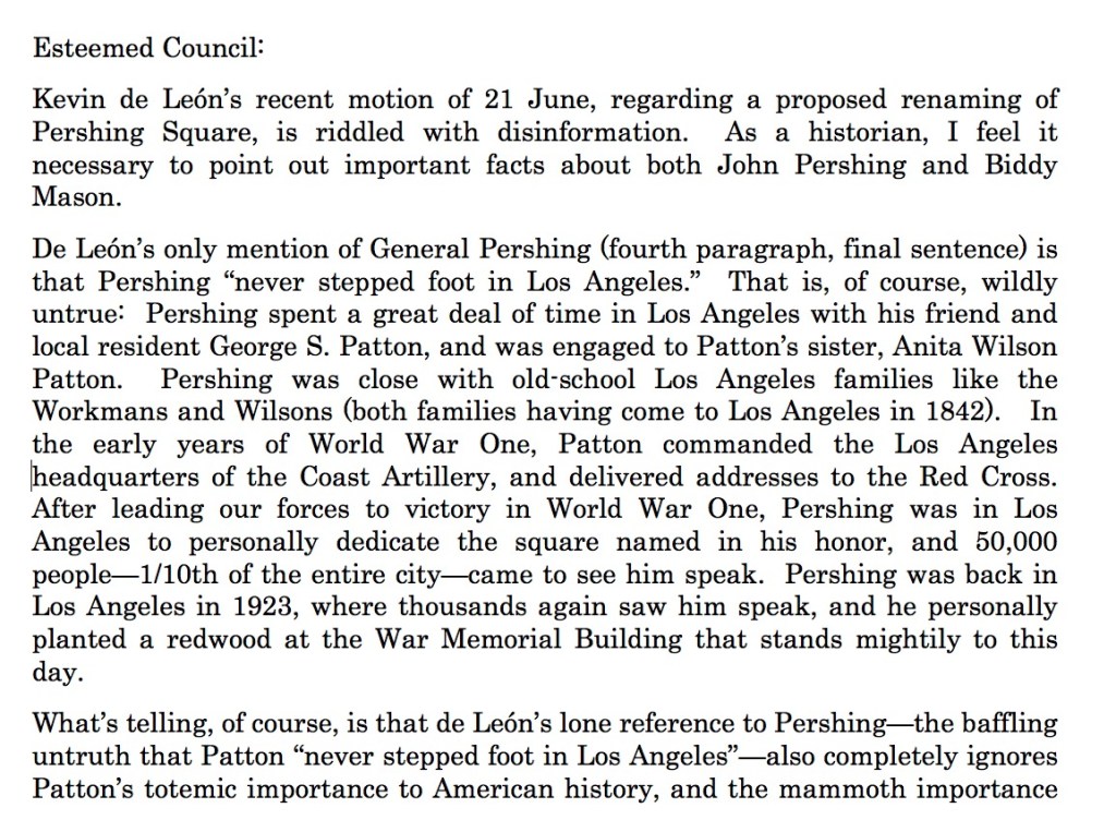
Not a lot going on with the renaming of Pershing Square; it’s still pending in committee (the Neighborhoods and Community Enrichment Committee, to be precise). I submitted a comment to the City Clerk, which you may read here, but it’s annoying that when one submits, their bot converts your message to a single paragraph. I’m not smart enough to figure out attaching PDFs, as Bob Wolfe did in his excellent “Communication from Public.” Therefore, here are my comments with the proper paragraph breaks:
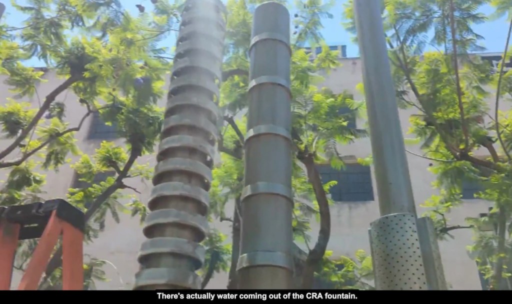
The big news, though, about Biddy Mason Memorial Park, is that the water features have been restored—
Those being the updates on that which falls under the “debunking Bunker” umbrella. One of these days I’ll tuck into some of the other juicy Los Angeles stories that so desperately need to be disproven…until then, then!
We all love great painters, especially those who depicted Los Angeles, right? And, subset of subset, specifically those who gravitated to Bunker Hill, capturing its picturesque charm.
Some favorites: the enchanting Leo Politi and his watercolors of Bunker Hill (there are libraries and schools and public squares named after the man, not to mention this exhibit). Ben Abril is well-loved for his picturesque California scenes, often focusing on old Los Angeles and Bunker Hill in particular. Emil Kosa Jr. is one of the great California scene painters and remembered for having captured Bunker Hill on his canvases; same with Victor Czerkas. And of course Millard Sheets, titan of Southern California regionalist scene painting, is best known for his masterpiece Angel’s Flight, a noirish tour de force about Bunker Hill, which hangs at LACMA.
And yet one of the greats is almost utterly unknown. Her name is Kay Martin—I love her, and you should too.
I. The Early Years
Eva Katherine Whittenberg is born in Springfield, Illinois, July 14 1910, to Eva (née Rice) and Alonzo Lindolf Whittenberg. Eva Katherine is the youngest of six girls born to Eva and Alonzo; Alonzo is a government secretary to the state of Illinois there in Springfield.
Eva Katherine grows up, and she goes by Kay. So it’s 1931, she’s 21 years old, and living in Bloomington, about sixty miles north of her native Springfield, attending Illinois Wesleyan University. There she meets a nice young fellow named Lowell Beckwith Martin—he goes by Beck. Beck is in the insurance game (his father Lester is the president of the Great States Insurance Company). Beck and Kay get married in September of ’31, lovely affair at St. Mathews Episcopal.
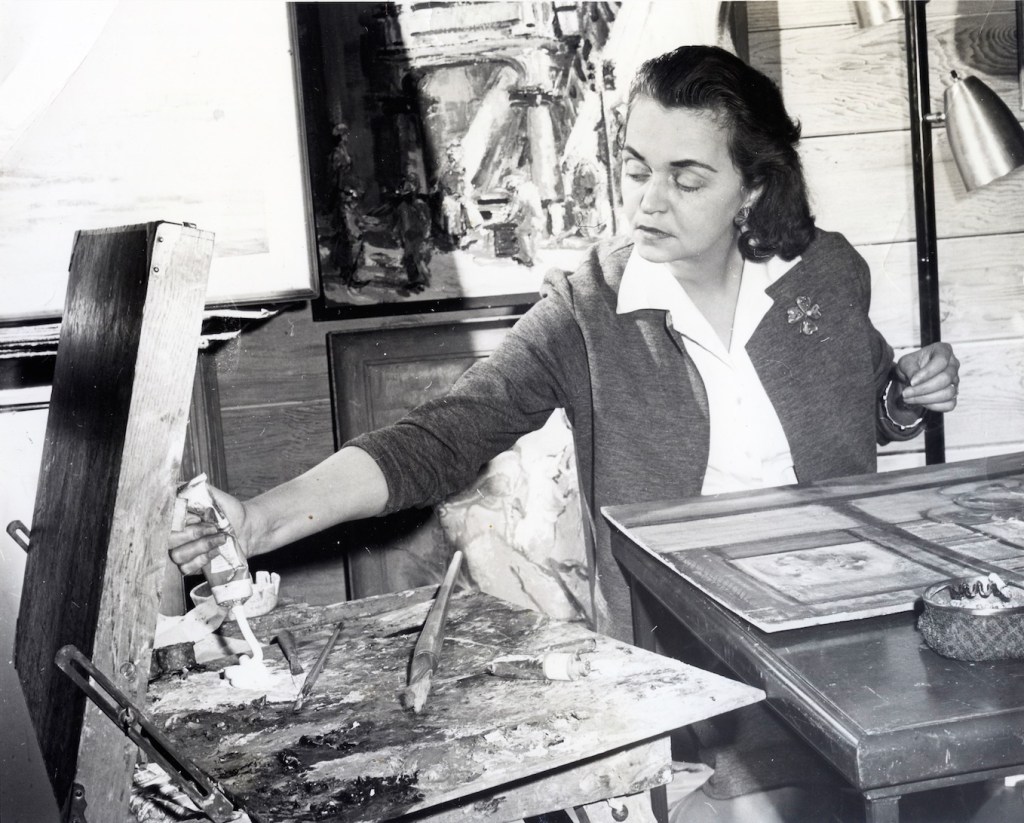
Kay has developed as an artist; her artistic training includes the Illinois State Normal School, where she took crafts and design, and the aforementioned Illinois Wesleyan University, where she excelled in her fine arts studies, and dug deep into the history of art and design. Kay and Beck had been married a decade and change when in 1943 they lit out for California, Glendale specifically: Lowell becomes an insurance man for Forest Lawn. Kay becomes a student of the great California landscape artist Ralph Holmes, and a student of famed English transplant California landscapist Dorothy Baugh, and a student of the unbelievably important “King of the Eucalyptus School” Sam Hyde Harris.
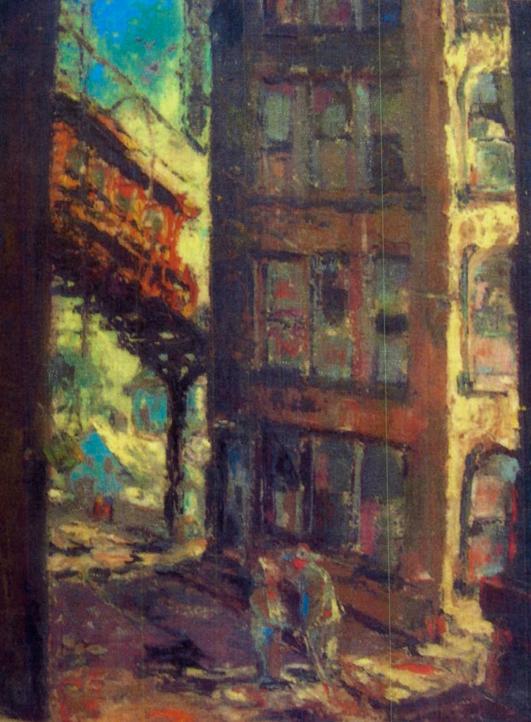
But she didn’t go that way, artistically, with all that plein-air painting among the trees of the arroyo, no. Back when Kay was attending Bloomington’s Illinois Wesleyan she began to developer her own style as a staunch urbanist. She depicted day workers, and WPA scenes, but once in Los Angeles her interest in the urban landscape would take her, though, down a different road from the Social Realists. Her aim was to capture the vanishing built environment, and have fun doing it.
II. The Productive Years
Kay’s living with Beck in Glendale, it’s 1955, and something catches her eye: Bunker Hill.
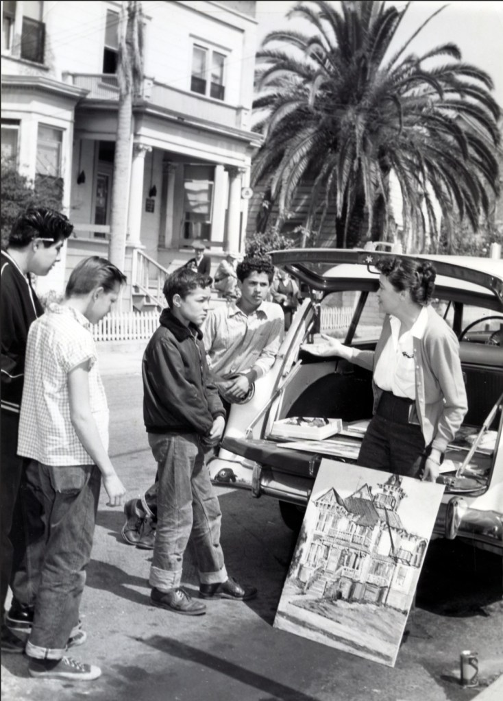
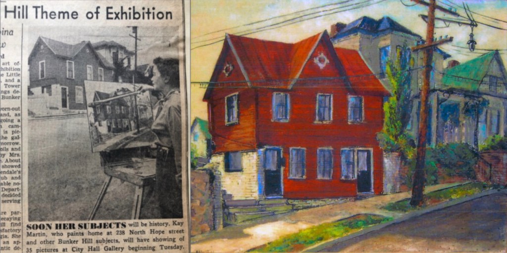
The vast swaths of Victorian buildings had been earmarked for demolition by the government and so, she set out for the Hill and began sketching. She would sketch and paint and sketch some more, and finish her paintings at home, and go back to the Hill and repeat the process. She became known as “The Vagabond of Bunker Hill.” The folks on the Hill came to know her well, and know her baby “Dreamboat,” the big white station wagon/rolling studio that came to visit the Hill near daily.
Kay’s parked across from the Earlcliff Apartments, at 231 South Bunker Hill Avenue. True to Los Angeles, there’s a Canary Island Date palm, king of palms. There’s her car, the Dreamboat, a 1952 Ford Ranch Wagon. She’s chatting up a bunch of straight-out-of-central-casting 50s teens, with their rolled-up Levis and pomade-slathered ducktail hairdos. She’s working on a painting of the Brousseau mansion which was on the south side of the street at 238, that is, out of frame foreground right.
Let’s take a look at some of Kay’s pictures.
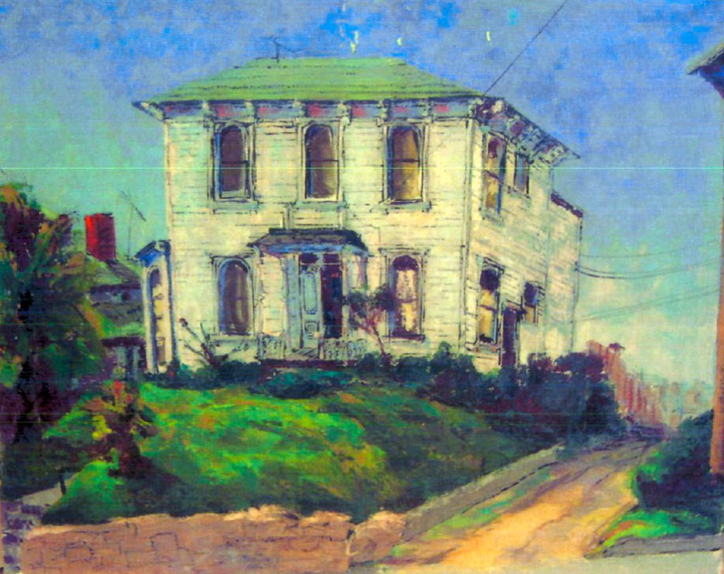
The Castle, 325 South Bunker Hill AvenueThe Salt Box, 339 South Bunker Hill AvenueThe Foss-Heindel House, 315 South Bunker Hill Avenue240-242 South Hope StreetThe benches, where Third Street dead-ended into Bunker Hill Avenue; 301 South Bunker Hill at leftLila Adele Hummel Foth was a noted silkscreen artist, designing mid-century linens for department stores. She was half the husband-and-wife painting team of Forrest and Lila Foth, and Lila had plans to produce a line of printed fabric with designs based on Bunker Hill houses. Needless to say, if that happened, I need some of it real bad.
The view north on Clay Street toward Angels Flight
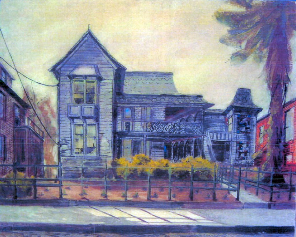
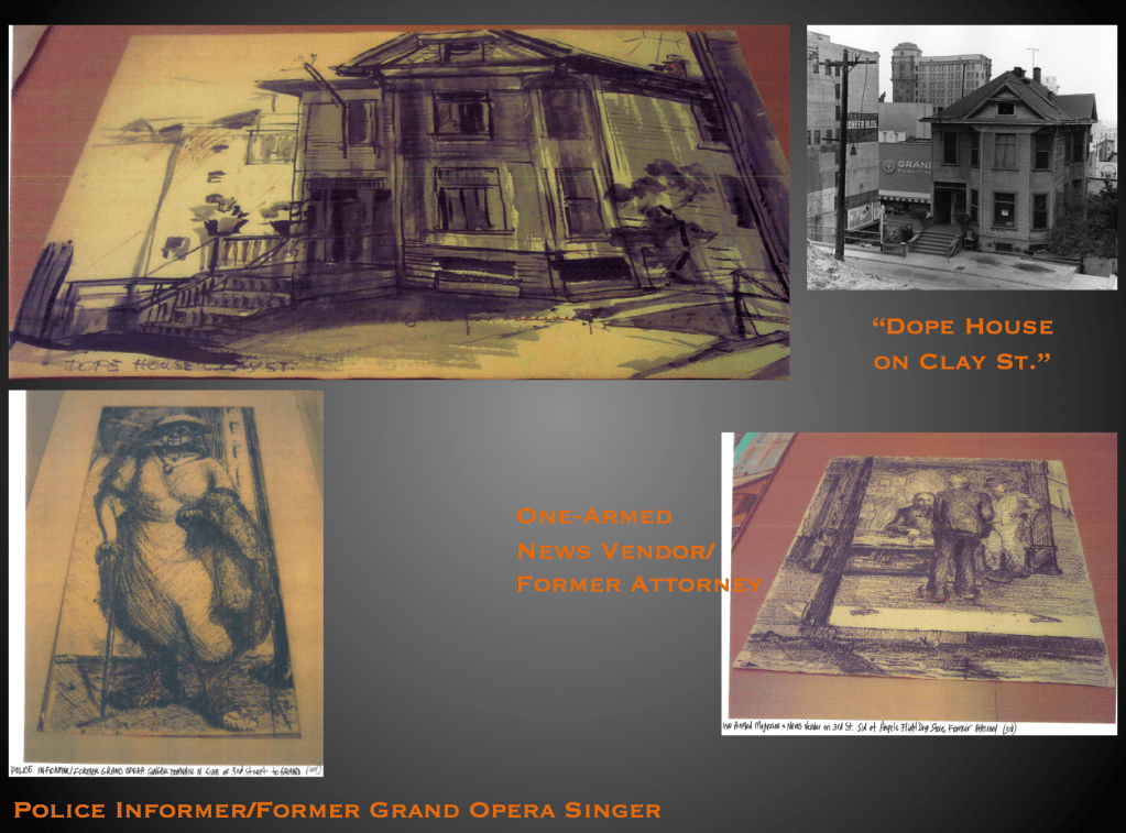
238 North Hope Street239 South Bunker Hill AvenueThe view south on Clay Street toward Fourth309 South Bunker Hill AvenueThe photograph of Kay’s “Dope House” (328 Clay Street) is from the LAPL
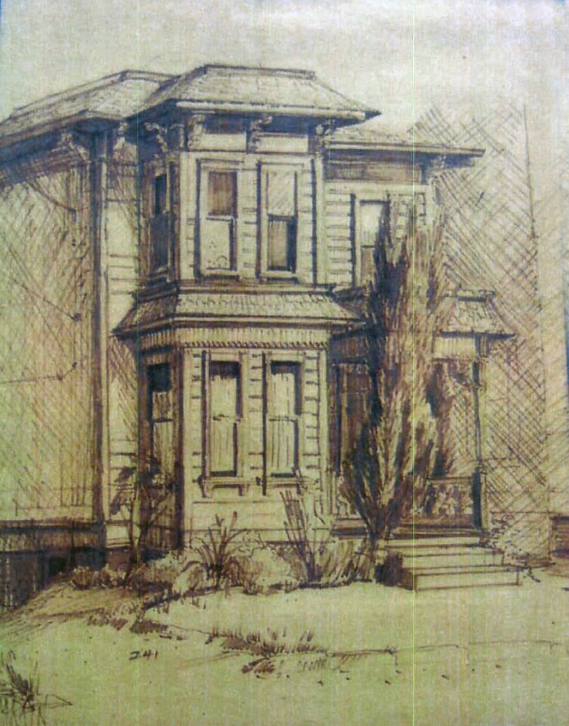
Sketch of 241 South Bunker Hill Avenue
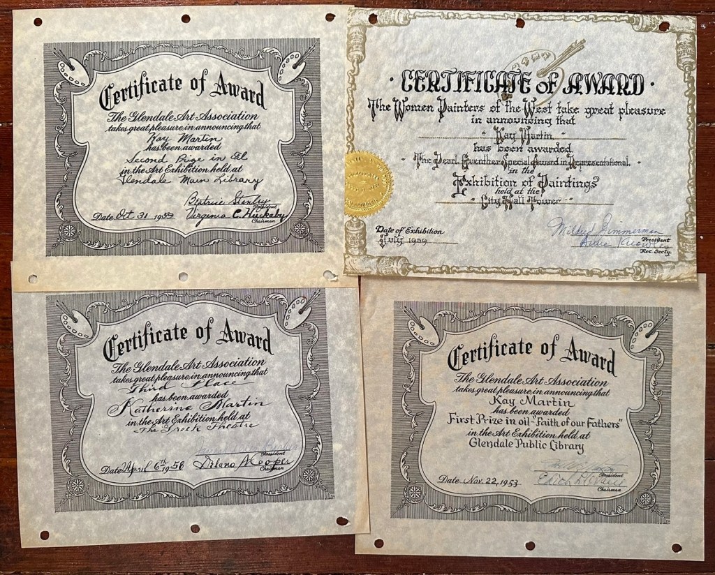
III. Kay Martin: Exhibition, Reception, Awards, Etc.
Now you’ve seen some of her great paintings. You might wonder, were they shown anywhere? Did anyone care? Short answer: they were quite popular. They were exhibited often, won scads of awards, and received dozens of press notices.
Kay Martin’s work was exhibited at the Greek Theater, the Ebell Club, the Tropico Branch Library, and the Casa Verdugo Library. She had shows at Panorama City’s Security First National Bank, and the Bank of America in La Canada, the Glendale Mutual Savings and Loan, and Security Pacific Bank-Prudential Square.
Her most towering achievement was the show in the Tower Gallery atop City Hall. It ran from June 26-July 20 1956 and featured thirty-five oils. To have a one-man show in the Tower Galley was unprecedented; that this “one-man show” was the work of a woman was absolutely groundbreaking. The show was an enormous success, garnering nearly 8,000 visitors.
Kay Martin served as director of the Glendale Art Association, and was a bigwig in the Laguna Beach Art Association, California Art Club, Foothill Artists Group, Foothill Painters, and the group Women Painters of the West. She sat on the board of the Tuesday Afternoon Club. She lectured widely, to every art association in the southland, and spoke to a variety of civic groups and fraternal organizations about old Los Angeles.
Martin won many local and three statewide awards.
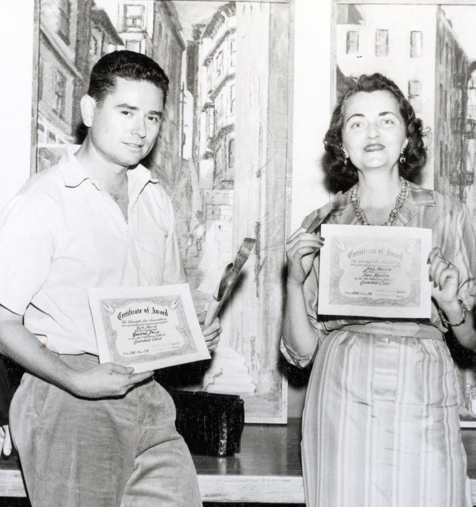
Kay and Ben Abril with their awards at the Glendale Civic, October 1959
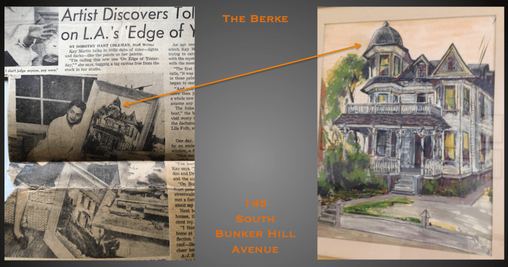
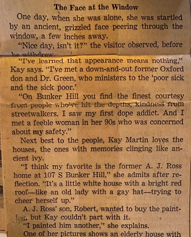
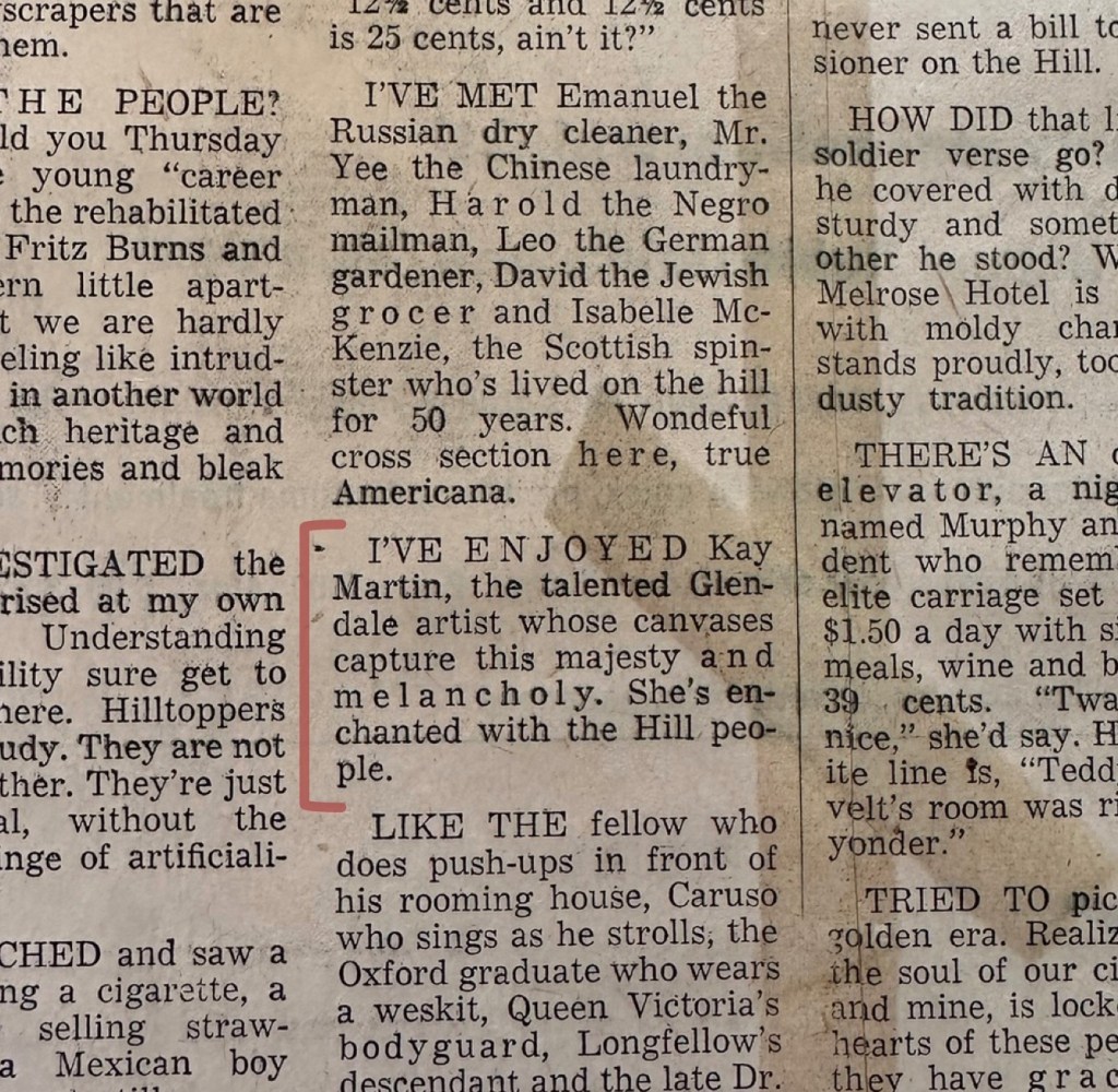
Kay had some interesting notices in the newspapers. There’s an especially charming piece about Kay in the January 15, 1958 issue of the Los Angeles Mirror, titled “Artist Discovers Tolerance on L.A.’s ‘Edge of Yesterday'” in which she describes the way visiting Bunker Hill changed her core:
With all my many articles and photographs, this is the sole mention of Wilhelmina. Perhaps it was Lila’s dog? I must have more Wilhelmina information!
Her painting of 107 South Bunker Hill Ave. is here
Her fondness for old houses is mirrored in her proclivity toward playing dress-up, and reliving the bygone days:
The gals of Kappa Kappa Gamma clown around in their olde-tyme garb on a Tin Lizzie—Kay on the running board—as part of a fundraiser: Oakmont Country Club, May 1957. Kay presented and narrated a costume tableaux…did she collect vintage clothes, too? Kay Martin gets a neat mention, among colorful depictions of the Hill and its denizens, in one of Joan Winchell’s columns, Los Angeles Times, June 10, 1956
IV. Later Years
With City Council’s 1959 passage of the Bunker Hill Urban Renewal Project, the 1960s began with a new under-demolition Bunker Hill, one replete with the sounds of jackhammers and splintering wood, its air full of plaster dust. Kay Martin turned her attention elsewhere.
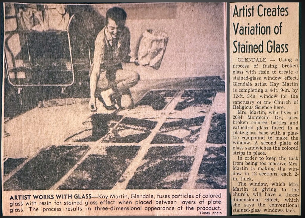
In early 1961, Martin reinvented stained glass:
Los Angeles Times, January 22, 1961
In the autumn of 1962, Kay and her pal Helen Wilkes made a sketching tour through Europe; Kay sold her works at the Independent Gallery, 112 South Maryland Avenue.
Kay also turned her eye to Glendale. Here she is—
Today the Victorian house at 221 North Belmont looks like this, and the rest of the block (the article notes this is “one of Glendale’s most historic streets”) has of course been sadly similarly redeveloped
—painting 221 North Belmont, the little white wooden home where Edith Nourse invited ten friends over for an 1898 birthday tea honoring Mittie Parker; so began the Tuesday Afternoon Club (which disbanded in 1998).
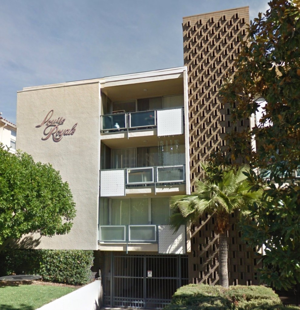
After the early 1960s, there’s little about Kay and Beck. We do know that about 1964, they lost their home to Eminent Domain, ironic, since Kay’s beloved Bunker Hill went that way, too. Their house at 2084 Montecito Drive, in the Montecito Park section of Glendale, about halfway between Oakmont Country Club on the west and Descanso Gardens on the east, was lost when the 2 freeway cut through. Kay and Beck moved into a brand-new apartment complex down in the flats, at 420 North Louise, Apt# 25.
The “Louise Royale,” with its bold script and 1960s styling, was the height of swank.
They were both in their mid-50s at this point, and presumably retired. Kay dies January 17 1978, and Beck follows the following August. While we’d expect them to be interred at Forest Lawn in their beloved Glendale, they both go back to Illinois.
Wiley Cemetery in Colfax, Illinois. Colfax is about 25 miles east of Bloomington, Beck’s hometown
And that, my friends, is the tale of Kay Martin.
V: But What Happened to Her Pictures?
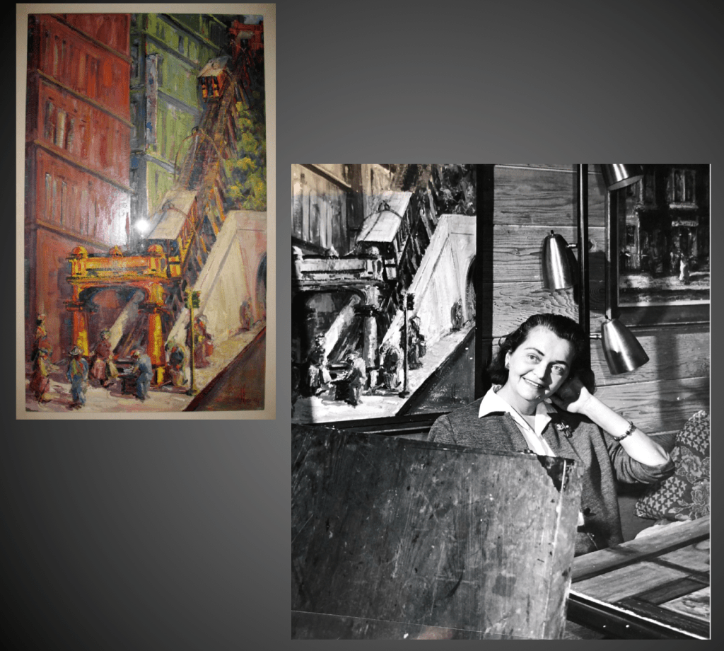
At this point, fellow Bunker wonk, you are suitably frustrated by these subpar reproductions of her paintings I have shared, and wish to immediately go view the originals wherever they hang, be it in a museum or private collection, and I would say yesyou must, adding I will meet you there and docent the living hell out of your experience. But, that’s not going to happen. Not today, probably not for a very long time. There’s a story here:
Kay Martin exhibited her pictures and they received great accolades, but unlike 99% of artists, she didn’t sell them. She kept the entire collection intact, because she had a very special plan for it, a vision. It was her stated intention that the entire collection be returned to Bunker Hill, to be hung in one of the “grand new hotels” destined to be built atop the new, modernized, post-redevelopment world there. Her paintings could act as a teaching aid, instructing and reminding people as to what the old, Victorian, lost world of Bunker Hill looked like.
Kay passes in 1978 and her estate is willed to sister Marjorie Reed, who lives back in Illinois. Marjorie lives another 14 years and dies in 1992, so all the paintings go to her son William E. Reed. At which point Kay’s nephew William, and wife Angela Reed, say dang, our house is now totally filled with these paintings, we need to deal with this, and more importantly we need to fulfill Kay’s wishes.
In 1994 Mickey Gustin, the Arts Planner for the Community Redevelopment Agency, starts getting letters. Like this one, saying, we want to donate this huge art collection to the CRA. The CRA, the Reeds figured, were the ones who could fulfill Kay’s wishes and place the pictures all together in one of “the new super hotels.”
The CRA says, ok, we’ll take ’em, and they’re packed up and sent back to Los Angeles whence they came. The CRA, now in possession of the pictures, requires eleven years to figure out where to display them. Apparently someone was walking through Angelus Plaza—America’s largest federally subsidized retirement community, on Bunker Hill at Third & Olive—and says wow, this place has got a lotta empty walls. And this place chock full of, you know, old people who actually like things like paintings, and who might actually remember Bunker Hill. So in 2005 Kay Martin’s pictures finally go on display up on the walls of Bunker Hill, at long last, in accordance with Kay’s wishes.
At this point, everything is copacetic: Kay’s pictures have been returned to Bunker Hill, and the old folks get to look at them wistfully, and those of us with a passion for old Bunker Hill get to visit and tour them:
Gordon Pattison, right, enjoys Kay’s picture of his family’s former home. Left, Kay sits on the tailgate of the Dreamboat, talking to Ollie Harp, the Castle’s manager and Gordon’s dear childhood friend
Until…one day in 2014. Story goes, someone at Angelus Plaza says let’s paint the walls. AP workers take down all the pictures, paint the walls, and then realize they have to rehang the pictues…which is just more work, so you can see the problem right there. Angelus Plaza figures it’s easier just to get rid of the damn things. They call up William Estrada, in the California History Department at the Natural History Museum and say you want em? and Dr. Estrada says hey, free stuff, why not. That’s the way I heard it, anyway; I’m sure the reality is much more nuanced, certainly more complicated, or perhaps completely different.
In any event, lawyers draw up a deed of gift that irrevocably and unconditionally assigns and transfers all legal title to the paintings from Angelus Plaza to the Natural History Museum. In January 2015 a couple of guys from LA Packing at $135 an hour show up, pack the stuff, haul it off to the Natural History warehouse in Carson.
Four years go by, and I’m working on my Bunker Hill book, so throughout 2019 I would on occasion attempt to contact William Estrada, Chief Curator and Chair of the History Department, about getting an image of one of the Kay Martin pictures. I never hear from him, which is disappointing, since I’d helped Bill when NHM was restoring their 1940 WPA model of downtown, but, whatever. So in January 2020 I turn my attention to collections manager Beth Werling. We discuss getting one of the paintings shot—they hadn’t even been photographed for in-house documentation purposes—for my book. But it doesn’t happen (hence, for the book, I used one of my black-and-white images alongside color pics of Sheets and Politi). NHM’s inability to photograph a painting was due to their losing the lease on their offsite warehouse in Carson, after which the entirety of NHM’s 3D/Material Culture collections was carted off to a new warehouse in Vernon, where all remains unpacked to this day, as the warehouse slogs through the process of upgrades, and the resulting City inspections.
And that’s that: ten years in, and the Natural History Museum has yet to so much as uncrate the paintings for cataloging. In the preparation of this post, curatorial questions regarding their future were again directed to Bill Estrada, who again, remains disinterested in speaking on the subject.
I hope however I have whet your appetite for Kay Martin and her works, and will, with me, look forward to some forthcoming exhibition.
*********
While I have you here: though there’s scant chance you’ll see Kay Martin’s paintings any time soon, I can at least share with you some of Kay’s sketches from my personal collection. Most of the work in my Kay Martin archive is from her 1962 European trip, but I do have a few nice Los Angeles examples:
*********
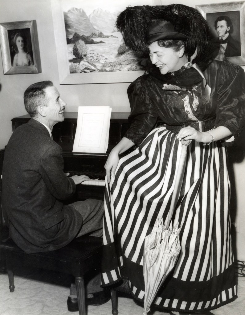
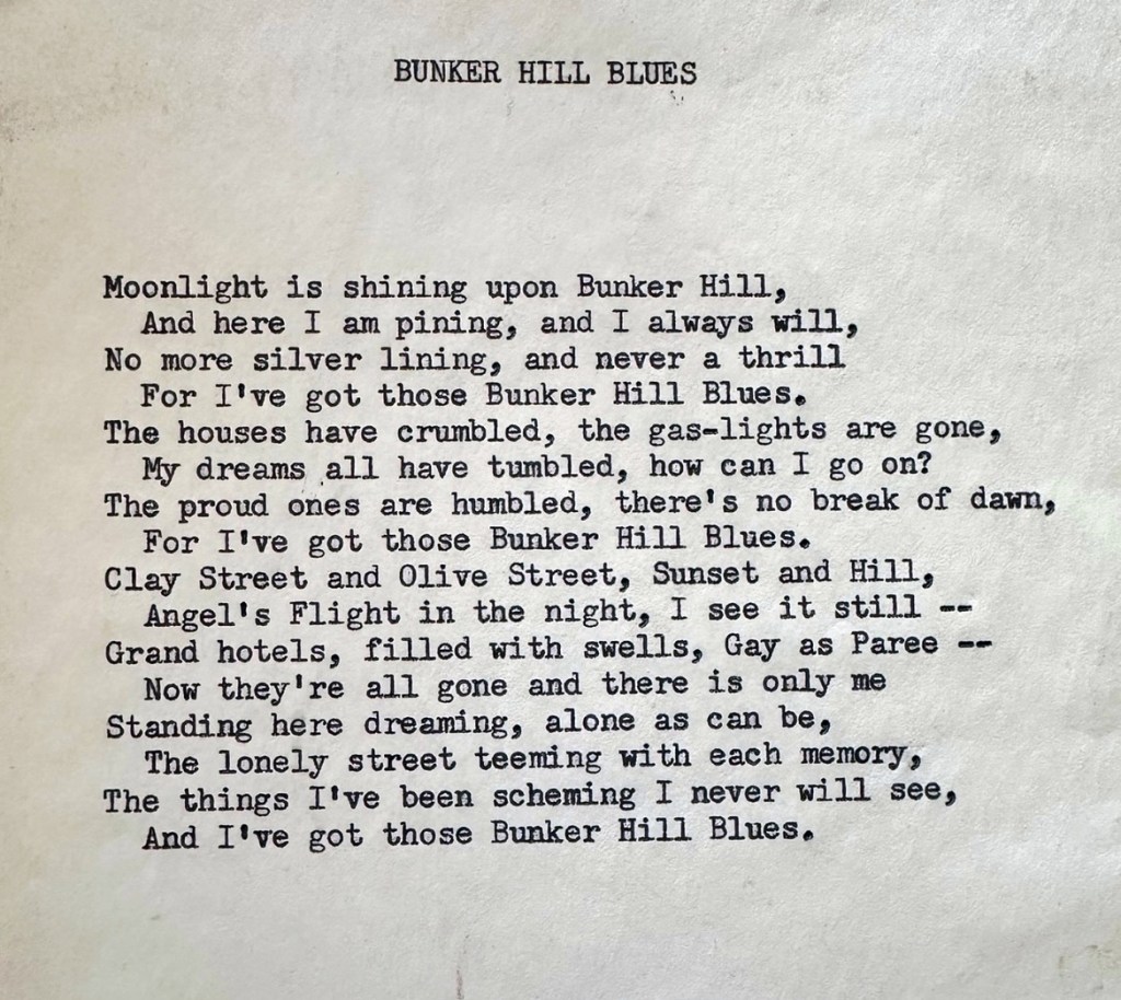
One last thing. April 11, 1958: at the Glendale Art Association’s “April Antics” held in the Tuesday Afternoon Clubhouse, Kay sang a ditty called Bunker Hill Blues. Here’s a shot of her performing it, with Association president James Alden Barber at the piano.
I’ve no idea what the music was. Judging by her garb it had a certain Gay Nineties jauntiness to it. Barber was composer, and I have his typewritten lyrics; the takeaway is neither gay nor jaunty, rather, I find the lyrics quite dark. I’m loath to call them mere lyrics—this is poetry, more to the point, the greatest poem ever written.
Today we talk about Pershing Square. Perhaps it’s not Bunker Hill proper—bordering the Hill’s southern edge—but I consider it an essential part of the Hill story. It is, after all, where so many of the Hill’s elderly residents spent their days (for example, go to 11:11 in the great 1956 documentary about Bunker Hill to witness a Pershing Square chat between an old fellow and William S. Burroughs’ doppelgänger). We’re also going to talk about Biddy Mason, who has a Bunker Hill connection: she owned the land on which African Methodist Episcopal had its church, at Fourth and Charity (now Grand, site of the Wells Fargo tower). She wouldn’t let the parishioners meet there, because the faithful owed her back taxes!
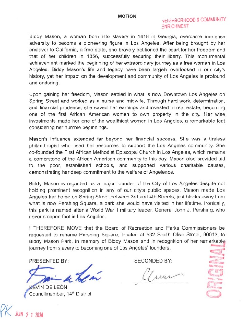
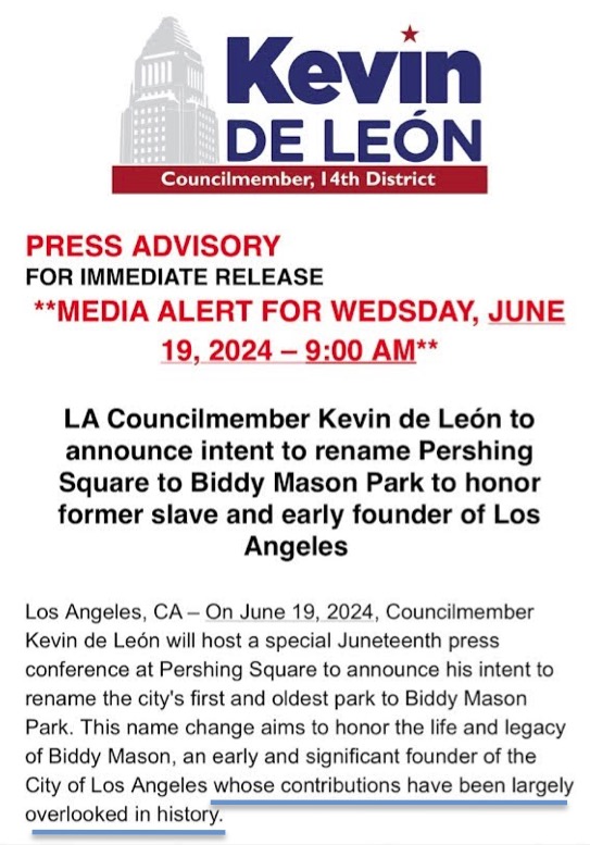
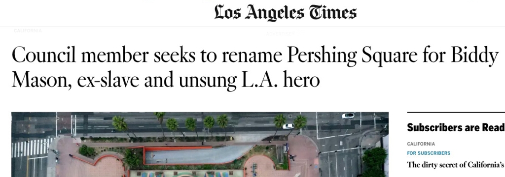
So, I deal today with Pershing Square and Biddy Mason, because there is a motion before Council to rename Pershing Square to Biddy Mason Park.
God bless KDL’s flair for the dramatic: the last line stating Mason was “one of Los Angeles’ founders” is an aggrandizement. Yes, Mason v. Smith is important to California history, and yes, in 1872 Biddy Mason was one of the twelve founders of the African Methodist Episcopal church, and yes, making a ton of money in real estate as a Black woman is quite an achievement. But none of those make her a “founder.”
Biddy Mason is, unquestionably, a fantastic and important part of LA, but the present narrative raises eyebrows. First of all, it comes from Kevin de León. It was de León’s office that pushed through the counterfactual Cooper Donut embarrassment, so, anything from that office involving “history” should be doubly scrutinized.
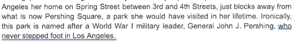
Right off the bat, in yesterday’s Council motion de León’s sole mention of Pershing is an absolute and ridiculous falsehood, stating “well, maybe Biddy Mason went to the park, but we know for a fact that Pershing certainly never did, because he never visited Los Angeles even once!”—
For the love of God, Kevin de León, if you’re going to LIE ABOUT EVERYTHING, at least do it WELL. Seriously, attempt some semblance of veracity.
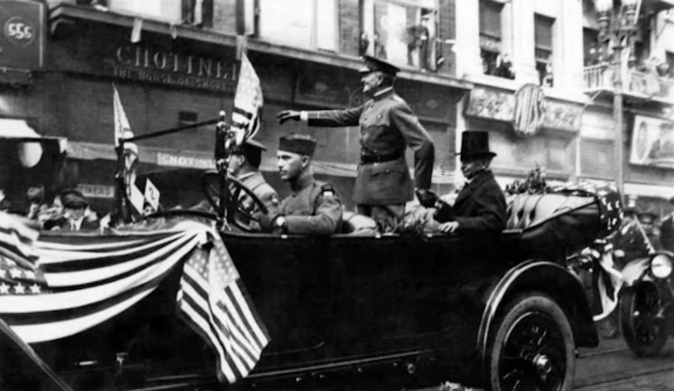
For the record: Pershing spent a LOT of time in Los Angeles: during World War One he commanded the headquarters of the Coast Artillery, AND delivered addresses to the Red Cross, AND Pershing was forever cavorting with his L.A. pal George S. Patton, Jr. while romancing George’s sister Anne at the Patton home in San Marino…which is where Pershing and Anne got engaged. Pershing was also pals with important old Los Angeles families like the Wilsons and the Workmans.
THEN in January 1920, when Pershing personally dedicated the square named in his honor, 50,000 people—1/10th of the entire city—came to see him speak.
Here’s Pershing, who KdL insists never set foot in Los Angeles, cruising down Broadway. Homestead Museum
Pershing is of course titanically important, and we’ll end this post with a bit more on him. But now, let’s grapple with de León’s need to have the park renamed.
One might contend that de León is only attempting the Biddy Mason rename because he got caught being a racist. He famously laughed along with casual racism (City Council president calling a Black child a monkey), and denigrated Black children as mere “props” like “handbags” (statements so egregious even Biden himself told de León to resign, a command de León simply ignored), and went on to say that the problem with Blacks is that when 25 of them yell, they sound like 250. No surprise, then, de León proffers some performative activism during his reelection campaign.
It’s important, therefore, to look critically at the claims being made about why we need a Biddy Mason park:
We need a Biddy Mason park!
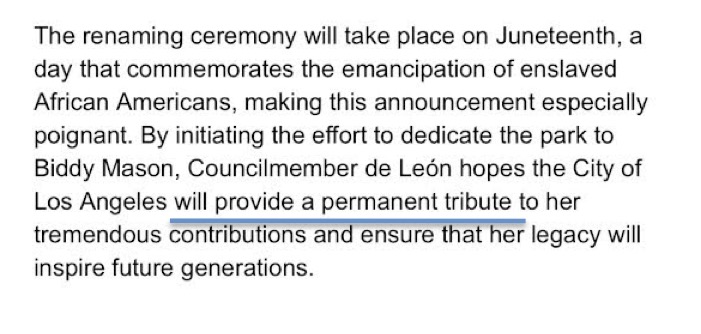
We already have a Biddy Mason park. Granted, it’s not five acres like Pershing Square, however, it’s still important to point out we’ve had a permanent tribute to Biddy Mason in Los Angeles for the last 35 years.
But the Biddy Mason park we have is terrible!
No, it’s really, really not. I work downtown and know every inch of that part of the world, and Biddy Mason Park is one of the few truly pleasant places in the central city. It’s away from the madness, it’s quiet, the birds chirp in the trees.
In the video above, shot in Pershing Square during the Juneteenth press conference, de León says “I do recall, the day, a few years ago, we were walking there, and I did actually ask you, wha-whe where are we going? And you said (unintelligible) and I said I know, but, we’re going to a parking lot right now. That’s where it is. A parking lot right now. It’s dark over there. You can not see the plaque on the wall, the memorial wall.”
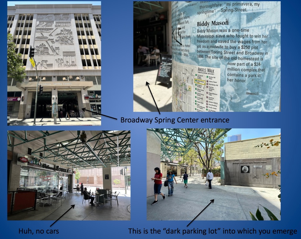
Remember above, where I said if you’re going to just lie, be better at it? Because this is just some dumb-ass lyin’. Here’s a video I shot walking to the “dark, unseeable” Biddy Mason Memorial in “the parking lot” that is Biddy Mason Park:
Walk past Maccheroni Republic, through the park’s trees and benches, to the sunlit memorial wall, to more trees and benches and tables, and look! There’s the back of the Bradbury Building! (Ok maybe I’m a nerd for this sort of thing but viewing the little-seen backside of a Victorian masterpiece is an incredible bonus)
There are five major entrances to the park, from Fourth, Spring, Third, and Broadway. If we’re going to be extremely charitable, de León, in stating he went to a “dark parking lot” is perhaps attempting to refer to the Spring Street entrance, which goes through a parking structure, via a pedestrian mall.
Ok fine we have a nice park in her honor, but still,Biddy Mason is unknown and unsung!
Let’s examine the claim that Biddy Mason is overlooked, unknown, and unsung.
Video ofKevin de León, announcing the renaming, stating “despite her extraordinary contributions, Biddy Mason’s legacy, quite frankly and honestly, has been largely overlooked”
Biddy Mason is an American hero; so is John J. Pershing. So I thought I’d do a quick (admittedly unscientific) comparison as to who’s actually more “unsung.” I went into the newspapers.com newspaper archive, to see how many times our southland newspapers mentioned Biddy Mason or General Pershing, since 1990. Turns out, in the last 34 years you’re more likely to read about Biddy Mason, than General Pershing. I even used multiple variations of ways Pershing might be mentioned, just to make certain I got them all. Still, Biddy beat John, 228 to 207 (I should mention as well, that because I used multiple variations of Pershing to cover all potential bases, the tally also therefore included repeats of single articles that referred to Pershing in multiple ways; the number of unique Pershing-mentioning articles is actually closer 125, revealing that Biddy Mason is mentioned more generally than Pershing by nearly 2-to-1).
So that’s it in a nutshell. Maybe Biddy Mason deserves more recognition, but at the expense of General Pershing? Can we not put a statue of her in Pershing Square?
And did I mention Kevin de León is not only going to rename Pershing Square, but also rename Spring Street? Yes, besides now having two parks named after Biddy Mason, we’ll also have 1.6 miles of Spring Street renamed to Biddy Mason Way. This includes the Spring Street Financial District, which is on the National Register of Historic Places. Pretty fitting, since Mason’s major claim to fame after achieving her freedom was becoming rich by being a capitalist landlord. (Hey, I thought we weren’t supposed to like capitalist landlords!)
************
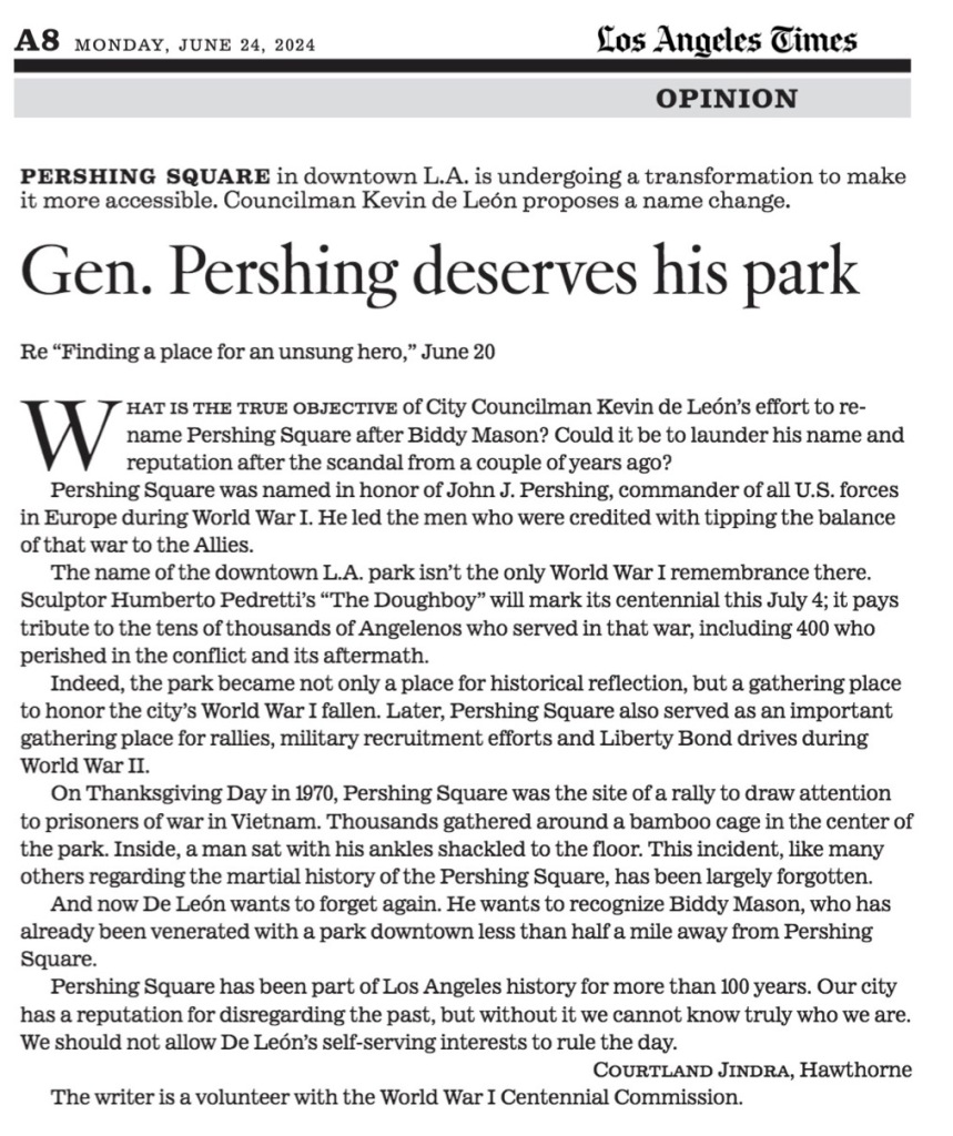
I will leave you with someone else’s words—Courtland Jindra, historian of the Great War—who can speak to Pershing’s importance better than I, and did so in a letter recently submitted to the editor of the Times, which said:
On June 19th, 2024 at Pershing Square, City Councilman Kevin de León announced his intention to push for the renaming of Pershing Square. I find this an unfortunate, but sadly expected, event in this city often accused of throwing out its history.
On the morning of November 15th, 1918 the City Council of Los Angeles renamed Central Square to Pershing Square, after the overall commander of the American Expeditionary Forces, John J, Pershing. He was the hero who had led the “boys” that had tipped the balance of the World War to the Allies and was nearly canonized at the time. Talk of renaming several things after him was also discussed, but what stuck was the park. The LA Times recorded that at the same meeting, a committee was formed to place a monument in the park “in honor of Gen Pershing and the American soldiers and sailors who participated in the war.”
This piece of history, like many others regarding the Square, has been largely forgotten. Even the park’s own website does not mention the date of the rededication, only that it was in 1918 – one has to track it down in archives. For many years, before and after the new name, Pershing Square was a place of historical reflection – especially for the military. A memorial to those lost in the 7th California Infantry, today’s 160th Infantry Regiment, in the Spanish American War, what is widely considered to be the first piece of public art in the city, was erected there in 1900. The previous Thanksgiving, a captured cannon from the same conflict was set in the park (this gun unfortunately was removed during the 1950’s redesign and has yet to be returned – today it resides in the Maritime Museum of San Pedro). Another cannon that had briefly been on the USS Constitution was brought to the city in the 1930s and resides in Pershing Square.
The park also served as places for two large outdoor funeral services for fallen soldiers from the war. Morris Lynchick’s 1921 ceremonial rites stopped the city in its tracks. He was the first soldier buried in Los Angeles and all the stops were pulled out as Lynchick seemed to symbolize all the men from the city who died in the war. Thousands came to bow their heads and pay their respects. A couple of years later the son of the former Mayor was likewise venerated. Ross Snyder was a decorated officer who gave his life in July of 1918 in an action that earned him the Silver Star. Again, the city honored him with a huge martial display in Pershing Square. Snyder is still remembered by a park bearing his name in South Los Angeles.
The World War memorial discussed back in 1918 did eventually come to fruition. There were tens of thousands of Angelenos that served in the First World War with over 400 perishing in the conflict and its pandemic fueled aftermath. Humberto Pedretti’s Doughboy, which will mark its centennial on the 4th of July this year, pays tribute to them. Its dedication was a massive deal and it is still, arguably, the most impressive element in the park. One might contend this is as it should be given its WWI connection. Doughboy towers roughly 25 feet from its base to the top of the flag that he strides to battle with. It’s a heroic depiction that seeks to evoke respect. The sides of the pedestal all have inscriptions that add to the effect. Dedicated “To the Sons and Daughters of Los Angeles who Participated in the World War” it has fallen into some disrepair in the time since it was put up, but when one stands in front of it, it does not fail to move you. Certainly, the Councilman could use some city funds to help restore this piece to its former glory.
It’s no surprise that given the large number of military tributes at Pershing Square, that during WWII, it was the city mecca for rallies, recruitment, and liberty bond drives. What is most interesting and depressing to me, as an amateur historian, is how all of this has been forgotten. Up until the latest design of the park, which we must remember is so disliked they’ve been working on redoing for at least a decade at this point, the war monuments and other memorial features (like Beethoven) all had prime real estate in the park. They were sprinkled around at entrances or centered. In other words, you couldn’t miss them. There were even large-scale Memorial Day services at the 7th California Infantry monument for decades at the Square, and at least a couple of pictures I’ve found indicate events at Doughboy on the 4th of July as well. Now the monuments and plaques are all ignored and largely hidden with low visibility. And now, with this proposed name change they’re certainly about to be even more forgotten.
Again on a Thanksgiving Day in 1970, Pershing Square took center stage to bring attention to the military. The park was specifically chosen to draw attention to Prisoners of War from the conflict in Vietnam. Thousands gathered around a bamboo cage in the center of the park. Inside, sat a bearded, ragged man, his ankles were shackled to the floor. He used chopsticks to slurp a sad holiday supper of pig fat, soupy rice and pumpkin. The ‘stunt’ garnered nationwide press at the time.
Even though other memorials to The Great War exist in this city, Pershing Square was the first. I understand that the park is not going to be 5 acres of history lessons, but to simply ignore this history because a City Councilman is trying to launder his name after the scandal from a couple of years ago is predictable but kind of unfortunate. Biddy Mason was a legendary figure in the early pioneer days as this former slave traveled west and built a life in the fledgling African American Community. However, as worthy of plaudits as she is, Mason already has a park named after her. Black Jack Pershing (who actually received his sobriquet from commanding Black troops in his early years as an officer) is not just the name of some city founder type, that people typically shrug off at localities all across the country. There was a reason that city officials renamed the park in the first place. It was to honor a man, and the amazing individuals under his command, that helped turn the tide of the largest struggle of history.
POSTSCRIPT
Jindra’s letter to the editor was published today, in an abbreviated form:
There were as well two other letters to the editor.
A woman named Ellen Switkes contends that renaming the park for Mason is not enough—for example, LAUSD should teach the story (except, as I’ve shown above, Mason is already part of the LAUSD curriculum) and there should be a “major biographical film” about Mason (this ignores the fact that biopics are frequently terrible [Blonde, All Eyez on Me, Gotti, Wired, Stardust, Beyond the Sea, ad nauseam] so be careful what you wish for; moreover, just because Mason gets a biopic doesn’t mean anyone will actually see it [the recent Till would have a similar audience, and despite good reviews, was ignored by audiences, failing to recoup most of its budget]).